Balnearia night lights from space
Night Light of Balnearia (Cordoba) from space (Argentina) Src. Average luminocity for 10x10km area is 5.0092% and for 50x50km: 0.4976%.
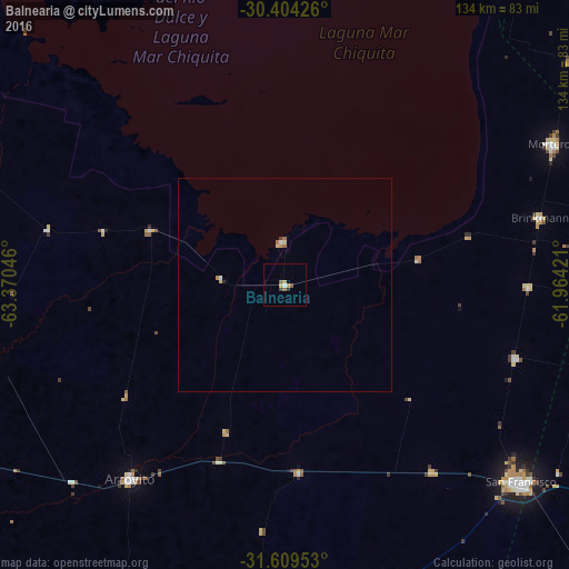
Analysis of Balnearia night lights 2016
Square area 10x10 km:
 0.73%
0.73%90-99
0%80-89
0.55%70-79
1.65%60-69
0.55%50-59
1.47%40-49
0.73%30-39
0.18%20-29
0.73%10-19
0%0-9
93.41%Square area 50x50 km:
0.07%90-99
0.02%80-89
0.12%70-79
0.12%60-69
0.04%50-59
0.13%40-49
0.04%30-39
0.03%20-29
0.06%10-19
0%0-9
99.38%Clear (daylight) street map image can be seen on geolist.org.
Map coordinates:
30° 24' 15.3" South, 63° 22' 13.7" West
31° 0' 31.7" South, 62° 40' 2.4" West
31° 36' 34.3" South, 61° 57' 51.2" West
Some cities around Balnearia sort by population:
• San Francisco
72.5 km =45 mi,  129°
129°
• Arroyito
58.5 km =36.4 mi,  218°
218°
• Morteros
71.9 km =44.7 mi,  62°
62°
• Las Varillas
96.1 km =59.7 mi,  182°
182°
• Brinkmann
62.1 km =38.6 mi,  75°
75°
• Villa del Totoral
102.4 km =63.6 mi,  282°
282°
• Santa Rosa de Río Primero
71.7 km =44.6 mi,  257°
257°
• Devoto
55.8 km =34.7 mi,  142°
142°
3864888 (p: 5,585)
Sources (retrieved 2019-11-25):
» Earth at Night: Flat Maps 2012, 2016