San Justo night lights from space
Night Light of San Justo (Santa Fe) from space (Argentina) Src. Average luminocity for 10x10km area is 17.0437% and for 50x50km: 1.0964%.
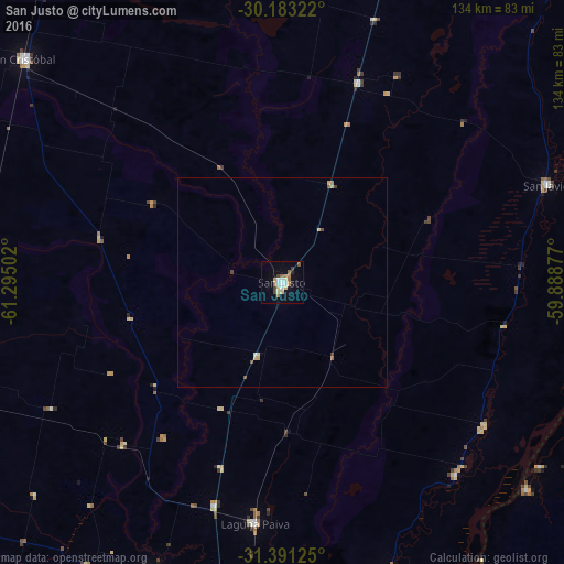
Analysis of San Justo night lights 2016
Square area 10x10 km:
 2.27%
2.27%90-99
2.62%80-89
2.8%70-79
0.87%60-69
4.02%50-59
2.1%40-49
1.57%30-39
1.22%20-29
0.7%10-19
6.82%0-9
75%Square area 50x50 km:
0.11%90-99
0.14%80-89
0.26%70-79
0.05%60-69
0.21%50-59
0.18%40-49
0.12%30-39
0.13%20-29
0.03%10-19
0.29%0-9
98.48%Clear (daylight) street map image can be seen on geolist.org.
Map coordinates:
30° 10' 59.6" South, 61° 17' 42.1" West
30° 47' 20.9" South, 60° 35' 30.8" West
31° 23' 28.5" South, 59° 53' 19.6" West
Some cities around San Justo sort by population:
• Esperanza
80.2 km =49.8 mi,  203°
203°
• La Paz
90.6 km =56.3 mi,  86°
86°
• Sunchales
94.1 km =58.5 mi,  259°
259°
• Santa Elena
78.6 km =48.8 mi,  102°
102°
• San Cristóbal
81.6 km =50.7 mi,  310°
310°
• Recreo
79.2 km =49.2 mi,  189°
189°
• Laguna Paiva
57.6 km =35.8 mi, 186°
• Villa Hernandarias
75.9 km =47.2 mi,  130°
130°
3837124 (p: 21,809)
Sources (retrieved 2019-11-25):
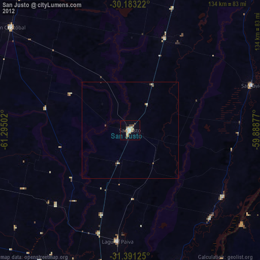
» Earth at Night: Flat Maps 2012, 2016