Santa Elena night lights from space
Night Light of Santa Elena (Entre Rios) from space (Argentina) Src. Average luminocity for 10x10km area is 10.0201% and for 50x50km: 1.4608%.
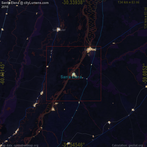
Analysis of Santa Elena night lights 2016
Square area 10x10 km:
 0.18%
0.18%90-99
1.28%80-89
1.83%70-79
1.83%60-69
2.75%50-59
0.73%40-49
0.92%30-39
2.38%20-29
1.28%10-19
0%0-9
86.81%Square area 50x50 km:
0.03%90-99
0.07%80-89
0.33%70-79
0.22%60-69
0.47%50-59
0.13%40-49
0.15%30-39
0.38%20-29
0.19%10-19
0.39%0-9
97.66%Clear (daylight) street map image can be seen on geolist.org.
Map coordinates:
30° 20' 21.8" South, 60° 29' 29.2" West
30° 56' 39.6" South, 59° 47' 18" West
31° 32' 43.7" South, 59° 5' 6.7" West
Some cities around Santa Elena sort by population:
• La Paz
26.3 km =16.3 mi,  31°
31°
• San Justo
78.6 km =48.8 mi,  282°
282°
• Federal
95.8 km =59.5 mi,  90°
90°
• San Javier
43 km =26.7 mi,  341°
341°
• Laguna Paiva
92 km =57.2 mi,  244°
244°
• Bovril
55.1 km =34.2 mi,  143°
143°
• Villa María Grande
80.9 km =50.3 mi,  187°
187°
• Villa Hernandarias
37 km =23 mi,  210°
210°
3428359 (p: 18,410)
Sources (retrieved 2019-11-25):
» Earth at Night: Flat Maps 2012, 2016