Laguna Paiva night lights from space
Night Light of Laguna Paiva (Santa Fe) from space (Argentina) Src. Average luminocity for 10x10km area is 11.5052% and for 50x50km: 3.3879%.
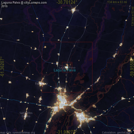
Analysis of Laguna Paiva night lights 2016
Square area 10x10 km:
 1.57%
1.57%90-99
1.22%80-89
0.7%70-79
0.7%60-69
3.67%50-59
1.92%40-49
1.4%30-39
2.1%20-29
0.7%10-19
1.4%0-9
84.62%Square area 50x50 km:
0.21%90-99
0.27%80-89
0.51%70-79
0.41%60-69
0.52%50-59
0.38%40-49
0.71%30-39
0.97%20-29
0.58%10-19
2.07%0-9
93.36%Clear (daylight) street map image can be seen on geolist.org.
Map coordinates:
30° 42' 4.5" South, 61° 21' 43.5" West
31° 18' 14.1" South, 60° 39' 32.2" West
31° 54' 9.9" South, 59° 57' 21" West
Some cities around Laguna Paiva sort by population:
• Santa Fe
38.6 km =24 mi,  187°
187°
• Paraná
49.2 km =30.6 mi,  165°
165°
• Santo Tomé
41.2 km =25.6 mi, 194°
• Esperanza
30.5 km =19 mi,  238°
238°
• San Justo
57.6 km =35.8 mi,  6°
6°
• Recreo
21.9 km =13.6 mi,  198°
198°
• San Carlos Centro
62.6 km =38.9 mi,  220°
220°
• San Benito
57.2 km =35.5 mi,  158°
158°
3850920 (p: 12,250)
Sources (retrieved 2019-11-25):
» Earth at Night: Flat Maps 2012, 2016