Sunchales night lights from space
Night Light of Sunchales (Santa Fe) from space (Argentina) Src. Average luminocity for 10x10km area is 18.3864% and for 50x50km: 1.6391%.
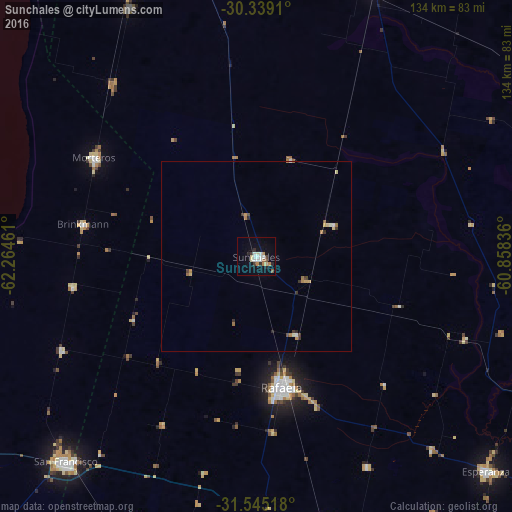
Analysis of Sunchales night lights 2016
Square area 10x10 km:
 3.48%
3.48%90-99
4.03%80-89
2.01%70-79
1.28%60-69
2.38%50-59
1.47%40-49
0.73%30-39
1.83%20-29
3.3%10-19
6.78%0-9
72.71%Square area 50x50 km:
0.19%90-99
0.24%80-89
0.24%70-79
0.18%60-69
0.36%50-59
0.12%40-49
0.14%30-39
0.33%20-29
0.23%10-19
0.27%0-9
97.69%Clear (daylight) street map image can be seen on geolist.org.
Map coordinates:
30° 20' 20.8" South, 62° 15' 52.6" West
30° 56' 38.5" South, 61° 33' 41.3" West
31° 32' 42.6" South, 60° 51' 30.1" West
Some cities around Sunchales sort by population:
• Rafaela
34.8 km =21.6 mi,  168°
168°
• San Francisco
73.2 km =45.5 mi,  222°
222°
• Esperanza
82.1 km =51 mi,  133°
133°
• San Justo
94.1 km =58.5 mi,  79°
79°
• Morteros
49.1 km =30.5 mi,  301°
301°
• San Cristóbal
77 km =47.8 mi,  23°
23°
• Brinkmann
46.2 km =28.7 mi,  280°
280°
• Devoto
87.4 km =54.3 mi,  234°
234°
3834971 (p: 18,757)
Sources (retrieved 2019-11-25):
» Earth at Night: Flat Maps 2012, 2016