Leones night lights from space
Night Light of Leones (Cordoba) from space (Argentina) Src. Average luminocity for 10x10km area is 14.6276% and for 50x50km: 2.0101%.
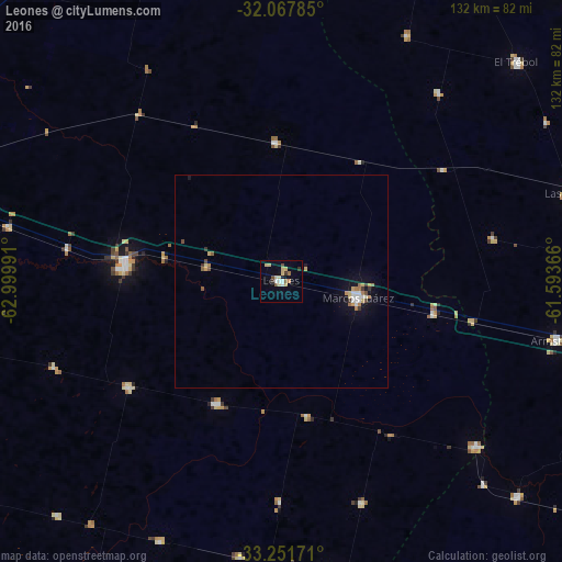
Analysis of Leones night lights 2016
Square area 10x10 km:
 1.05%
1.05%90-99
1.75%80-89
5.94%70-79
0.35%60-69
1.57%50-59
1.4%40-49
1.22%30-39
2.1%20-29
0%10-19
1.57%0-9
83.04%Square area 50x50 km:
0.2%90-99
0.26%80-89
0.42%70-79
0.22%60-69
0.31%50-59
0.17%40-49
0.19%30-39
0.29%20-29
0%10-19
1.1%0-9
96.85%Clear (daylight) street map image can be seen on geolist.org.
Map coordinates:
32° 4' 4.3" South, 62° 59' 59.7" West
32° 39' 42.3" South, 62° 17' 48.4" West
33° 15' 6.2" South, 61° 35' 37.2" West
Some cities around Leones sort by population:
• Bell Ville
36.9 km =22.9 mi,  276°
276°
• Marcos Juárez
18.2 km =11.3 mi,  102°
102°
• Armstrong
66.3 km =41.2 mi, 101°
• Corral de Bustos
69.8 km =43.4 mi,  171°
171°
• Justiniano Posse
43.4 km =27 mi,  235°
235°
• Monte Maíz
66.7 km =41.4 mi,  205°
205°
• Cruz Alta
59.8 km =37.2 mi,  130°
130°
• Monte Buey
32 km =19.9 mi, 207°
3846991 (p: 9,971)
Sources (retrieved 2019-11-25):
» Earth at Night: Flat Maps 2012, 2016