Justiniano Posse night lights from space
Night Light of Justiniano Posse (Cordoba) from space (Argentina) Src. Average luminocity for 10x10km area is 7.0476% and for 50x50km: 0.8396%.
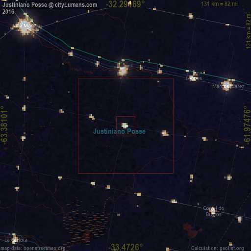
Analysis of Justiniano Posse night lights 2016
Square area 10x10 km:
 0.73%
0.73%90-99
0.92%80-89
3.48%70-79
0%60-69
1.47%50-59
0%40-49
0%30-39
0%20-29
0.73%10-19
0.73%0-9
91.94%Square area 50x50 km:
0.09%90-99
0.09%80-89
0.2%70-79
0.18%60-69
0.09%50-59
0.05%40-49
0.03%30-39
0.13%20-29
0.06%10-19
0.07%0-9
99.01%Clear (daylight) street map image can be seen on geolist.org.
Map coordinates:
32° 17' 30.1" South, 63° 22' 51.6" West
32° 53' 2.8" South, 62° 40' 40.4" West
33° 28' 21.4" South, 61° 58' 29.1" West
Some cities around Justiniano Posse sort by population:
• Bell Ville
28.7 km =17.8 mi,  357°
357°
• Marcos Juárez
57.3 km =35.6 mi,  68°
68°
• Villa Nueva
73.2 km =45.5 mi,  313°
313°
• Leones
43.4 km =27 mi,  55°
55°
• Corral de Bustos
63.8 km =39.6 mi,  133°
133°
• Monte Maíz
36.4 km =22.6 mi,  168°
168°
• Monte Buey
21 km =13 mi,  99°
99°
• Laborde
34.2 km =21.3 mi,  209°
209°
3853331 (p: 7,406)
Sources (retrieved 2019-11-25):
» Earth at Night: Flat Maps 2012, 2016