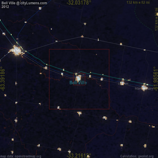
Bell Ville night lights from space
Night Light of Bell Ville (Cordoba) from space (Argentina) Src. Average luminocity for 10x10km area is 26.5822% and for 50x50km: 1.9457%.
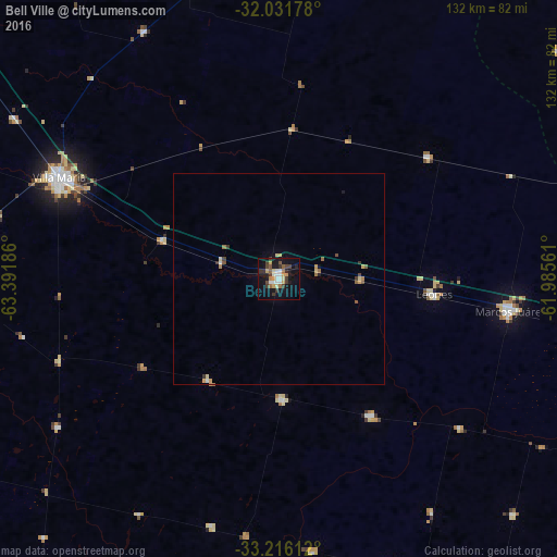
Analysis of Bell Ville night lights 2016
Square area 10x10 km:
 3.5%
3.5%90-99
4.2%80-89
3.15%70-79
4.37%60-69
1.57%50-59
2.62%40-49
3.67%30-39
7.87%20-29
1.92%10-19
26.57%0-9
40.56%Square area 50x50 km:
0.17%90-99
0.2%80-89
0.31%70-79
0.33%60-69
0.2%50-59
0.25%40-49
0.29%30-39
0.47%20-29
0.09%10-19
1.19%0-9
96.48%Clear (daylight) street map image can be seen on geolist.org.
Map coordinates:
32° 1' 54.4" South, 63° 23' 30.7" West
32° 37' 33.3" South, 62° 41' 19.4" West
33° 12' 58" South, 61° 59' 8.2" West
Some cities around Bell Ville sort by population:
• Villa María
57.1 km =35.5 mi,  295°
295°
• Marcos Juárez
55.1 km =34.2 mi,  98°
98°
• Villa Nueva
56.6 km =35.2 mi,  292°
292°
• Leones
36.9 km =22.9 mi, 96°
• Justiniano Posse
28.7 km =17.8 mi,  177°
177°
• Monte Maíz
64.9 km =40.3 mi,  172°
172°
• Monte Buey
38.9 km =24.2 mi,  146°
146°
• Laborde
60.7 km =37.7 mi,  194°
194°
3864331 (p: 35,105)
Sources (retrieved 2019-11-25):
» Earth at Night: Flat Maps 2012, 2016