Armstrong night lights from space
Night Light of Armstrong (Santa Fe) from space (Argentina) Src. Average luminocity for 10x10km area is 12.9423% and for 50x50km: 2.6672%.
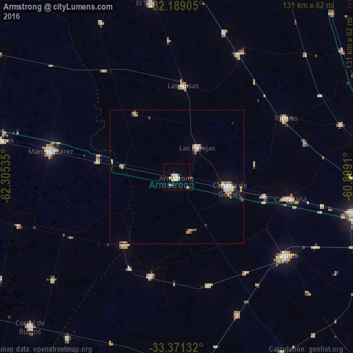
Analysis of Armstrong night lights 2016
Square area 10x10 km:
 1.92%
1.92%90-99
1.75%80-89
3.32%70-79
1.4%60-69
0.7%50-59
1.4%40-49
0.7%30-39
1.92%20-29
0.52%10-19
1.05%0-9
85.31%Square area 50x50 km:
0.38%90-99
0.38%80-89
0.42%70-79
0.33%60-69
0.35%50-59
0.29%40-49
0.17%30-39
0.38%20-29
0.2%10-19
1.12%0-9
95.99%Clear (daylight) street map image can be seen on geolist.org.
Map coordinates:
32° 11' 20.6" South, 62° 18' 19.3" West
32° 46' 55.7" South, 61° 36' 8" West
33° 22' 16.8" South, 60° 53' 56.8" West
Some cities around Armstrong sort by population:
• Cañada de Gómez
19.7 km =12.2 mi,  101°
101°
• Casilda
49.9 km =31 mi,  125°
125°
• Marcos Juárez
48.1 km =29.9 mi,  281°
281°
• Carcarañá
42.8 km =26.6 mi, 101°
• Las Rosas
34 km =21.1 mi,  3°
3°
• Las Parejas
13.5 km =8.4 mi,  36°
36°
• Totoras
46.2 km =28.7 mi,  61°
61°
• Cruz Alta
31.7 km =19.7 mi,  217°
217°
3865449 (p: 10,388)
Sources (retrieved 2019-11-25):
» Earth at Night: Flat Maps 2012, 2016