General Cabrera night lights from space
Night Light of General Cabrera (Cordoba) from space (Argentina) Src. Average luminocity for 10x10km area is 15.7564% and for 50x50km: 1.8035%.
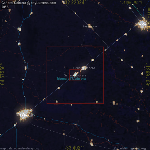
Analysis of General Cabrera night lights 2016
Square area 10x10 km:
 1.09%
1.09%90-99
4%80-89
2.91%70-79
2.36%60-69
2%50-59
0%40-49
0.18%30-39
1.27%20-29
1.45%10-19
9.64%0-9
75.09%Square area 50x50 km:
0.24%90-99
0.27%80-89
0.44%70-79
0.19%60-69
0.22%50-59
0.06%40-49
0.04%30-39
0.28%20-29
0.09%10-19
0.83%0-9
97.36%Clear (daylight) street map image can be seen on geolist.org.
Map coordinates:
32° 13' 12.9" South, 64° 34' 32" West
32° 48' 47.3" South, 63° 52' 20.7" West
33° 24' 7.6" South, 63° 10' 9.5" West
Some cities around General Cabrera sort by population:
• Río Cuarto
56.8 km =35.3 mi,  231°
231°
• Villa María
74.4 km =46.2 mi,  52°
52°
• Río Tercero
74.7 km =46.4 mi,  342°
342°
• Villa Nueva
72.2 km =44.9 mi, 54°
• Hernando
44.9 km =27.9 mi,  16°
16°
• Berrotarán
62.9 km =39.1 mi,  309°
309°
• Las Higueras
49.7 km =30.9 mi, 231°
• Tancacha
64.2 km =39.9 mi,  350°
350°
3855124 (p: 10,351)
Sources (retrieved 2019-11-25):
» Earth at Night: Flat Maps 2012, 2016