Tancacha night lights from space
Night Light of Tancacha (Cordoba) from space (Argentina) Src. Average luminocity for 10x10km area is 6.9927% and for 50x50km: 2.4376%.
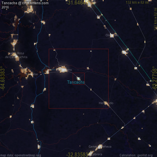
Analysis of Tancacha night lights 2016
Square area 10x10 km:
 1.1%
1.1%90-99
1.1%80-89
1.28%70-79
1.47%60-69
0.18%50-59
0.73%40-49
0.37%30-39
0.92%20-29
0.92%10-19
0.73%0-9
91.21%Square area 50x50 km:
0.3%90-99
0.24%80-89
0.5%70-79
0.26%60-69
0.44%50-59
0.2%40-49
0.18%30-39
0.23%20-29
0.26%10-19
1.88%0-9
95.5%Clear (daylight) street map image can be seen on geolist.org.
Map coordinates:
31° 38' 47.2" South, 64° 41' 1.8" West
32° 14' 35.1" South, 63° 58' 50.5" West
32° 50' 9" South, 63° 16' 39.3" West
Some cities around Tancacha sort by population:
• Río Tercero
14.8 km =9.2 mi,  301°
301°
• Embalse
41.7 km =25.9 mi,  279°
279°
• Oncativo
46.2 km =28.7 mi,  37°
37°
• Oliva
44.7 km =27.8 mi,  59°
59°
• Almafuerte
26.5 km =16.5 mi, 282°
• Hernando
30.9 km =19.2 mi,  131°
131°
• Laguna Larga
54.6 km =33.9 mi,  18°
18°
• Berrotarán
44.8 km =27.8 mi,  238°
238°
3834665 (p: 5,184)
Sources (retrieved 2019-11-25):
» Earth at Night: Flat Maps 2012, 2016