Berrotarán night lights from space
Night Light of Berrotarán (Cordoba) from space (Argentina) Src. Average luminocity for 10x10km area is 5.8077% and for 50x50km: 0.9864%.
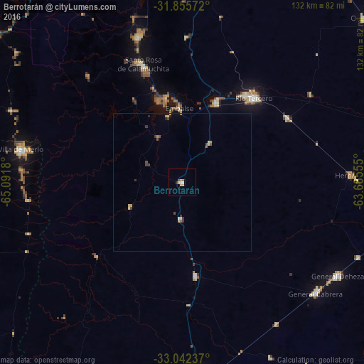
Analysis of Berrotarán night lights 2016
Square area 10x10 km:
 0.37%
0.37%90-99
1.1%80-89
2.2%70-79
0.73%60-69
0.73%50-59
0%40-49
0.73%30-39
0.73%20-29
0%10-19
0%0-9
93.41%Square area 50x50 km:
0.04%90-99
0.07%80-89
0.26%70-79
0.14%60-69
0.14%50-59
0.04%40-49
0.27%30-39
0.21%20-29
0.08%10-19
0.1%0-9
98.65%Clear (daylight) street map image can be seen on geolist.org.
Map coordinates:
31° 51' 20.6" South, 65° 5' 30.5" West
32° 27' 3.6" South, 64° 23' 19.2" West
33° 2' 32.5" South, 63° 41' 8" West
Some cities around Berrotarán sort by population:
• Río Tercero
40.3 km =25 mi,  39°
39°
• Embalse
30.3 km =18.8 mi,  354°
354°
• Merlo
59.9 km =37.2 mi,  281°
281°
• Almafuerte
31.3 km =19.4 mi,  23°
23°
• Hernando
61.6 km =38.3 mi,  87°
87°
• Santa Rosa de Calamuchita
44.7 km =27.8 mi,  341°
341°
• Villa General Belgrano
54.9 km =34.1 mi, 343°
• Tancacha
44.8 km =27.8 mi,  58°
58°
3864274 (p: 6,446)
Sources (retrieved 2019-11-25):
» Earth at Night: Flat Maps 2012, 2016