Río Tercero night lights from space
Night Light of Río Tercero (Cordoba) from space (Argentina) Src. Average luminocity for 10x10km area is 32.3091% and for 50x50km: 2.874%.
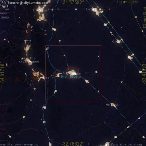
Analysis of Río Tercero night lights 2016
Square area 10x10 km:
 6.36%
6.36%90-99
4.91%80-89
6.18%70-79
2.18%60-69
6.55%50-59
1.64%40-49
1.82%30-39
2%20-29
2.73%10-19
41.64%0-9
24%Square area 50x50 km:
0.34%90-99
0.34%80-89
0.62%70-79
0.25%60-69
0.44%50-59
0.23%40-49
0.23%30-39
0.39%20-29
0.32%10-19
1.85%0-9
94.98%Clear (daylight) street map image can be seen on geolist.org.
Map coordinates:
31° 34' 33.3" South, 64° 49' 1.8" West
32° 10' 22.8" South, 64° 6' 50.6" West
32° 45' 58.4" South, 63° 24' 39.3" West
Some cities around Río Tercero sort by population:
• Embalse
28.6 km =17.8 mi,  268°
268°
• Almafuerte
13.5 km =8.4 mi,  260°
260°
• Hernando
45.6 km =28.3 mi,  128°
128°
• Santa Rosa de Calamuchita
41.4 km =25.7 mi,  286°
286°
• Berrotarán
40.3 km =25 mi,  219°
219°
• Villa General Belgrano
47 km =29.2 mi,  297°
297°
• Despeñaderos
43 km =26.7 mi,  337°
337°
• Tancacha
14.8 km =9.2 mi,  121°
121°
3838793 (p: 53,389)
Sources (retrieved 2019-11-25):
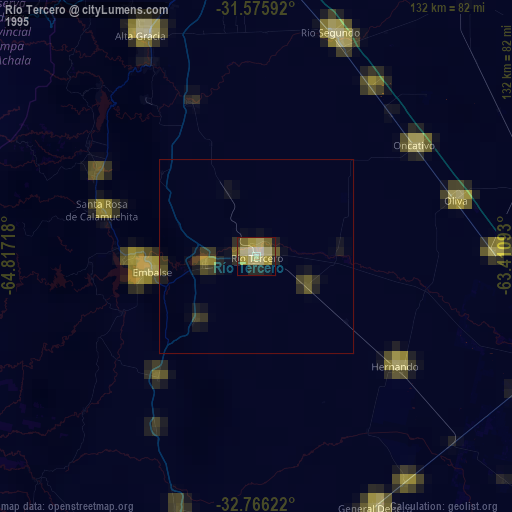
» NASA, Earths city lights 1995
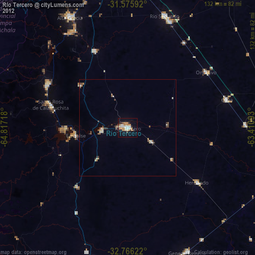
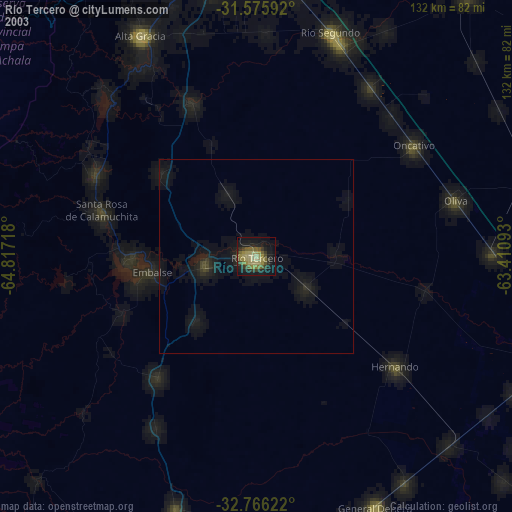
» NASA city lights 2003
» Earth at Night: Flat Maps 2012, 2016