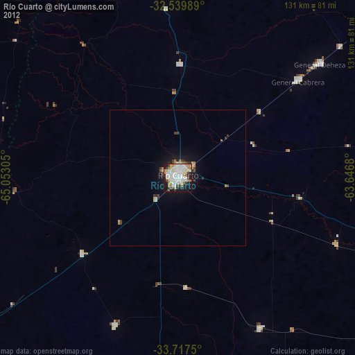
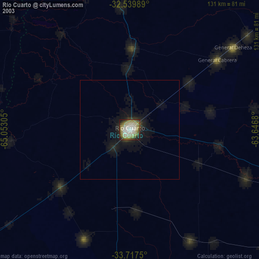
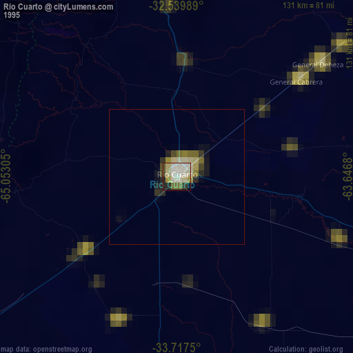
Río Cuarto night lights from space
Night Light of Río Cuarto (Cordoba) from space (Argentina) Src. Average luminocity for 10x10km area is 70.4414% and for 50x50km: 4.4054%.

Analysis of Río Cuarto night lights 2016
Square area 10x10 km:
 20.7%
20.7%90-99
22.71%80-89
6.04%70-79
11.72%60-69
7.51%50-59
1.65%40-49
4.58%30-39
3.48%20-29
15.57%10-19
6.04%0-9
0%Square area 50x50 km:
0.83%90-99
0.92%80-89
0.4%70-79
0.58%60-69
0.57%50-59
0.25%40-49
0.31%30-39
0.63%20-29
1.25%10-19
3.07%0-9
91.19%Clear (daylight) street map image can be seen on geolist.org.
Map coordinates:
32° 32' 23.6" South, 65° 3' 11" West
33° 7' 50.4" South, 64° 20' 59.7" West
33° 43' 3" South, 63° 38' 48.5" West
Some cities around Río Cuarto sort by population:
• Hernando
97.2 km =60.4 mi,  36°
36°
• General Cabrera
56.8 km =35.3 mi,  51°
51°
• Vicuña Mackenna
87.8 km =54.6 mi,  182°
182°
• Coronel Moldes
59.3 km =36.8 mi,  202°
202°
• Sampacho
44.6 km =27.7 mi,  230°
230°
• Berrotarán
75.7 km =47 mi,  357°
357°
• Adelia María
63.5 km =39.5 mi,  151°
151°
• Las Higueras
7.1 km =4.4 mi, 53°
3838874 (p: 153,757)
Sources (retrieved 2019-11-25):
» NASA, Earths city lights 1995
» NASA city lights 2003
» Earth at Night: Flat Maps 2012, 2016