El Trébol night lights from space
Night Light of El Trébol (Santa Fe) from space (Argentina) Src. Average luminocity for 10x10km area is 9.9808% and for 50x50km: 1.268%.
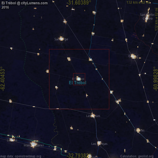
Analysis of El Trébol night lights 2016
Square area 10x10 km:
 2.27%
2.27%90-99
1.92%80-89
2.1%70-79
0%60-69
1.4%50-59
0.35%40-49
1.05%30-39
0.7%20-29
0%10-19
0%0-9
90.21%Square area 50x50 km:
0.21%90-99
0.18%80-89
0.25%70-79
0.22%60-69
0.18%50-59
0.02%40-49
0.17%30-39
0.14%20-29
0%10-19
0%0-9
98.63%Clear (daylight) street map image can be seen on geolist.org.
Map coordinates:
31° 36' 14" South, 62° 24' 16.3" West
32° 12' 2.9" South, 61° 42' 5" West
32° 47' 37.8" South, 60° 59' 53.8" West
Some cities around El Trébol sort by population:
• Marcos Juárez
67.1 km =41.7 mi,  214°
214°
• Gálvez
49.1 km =30.5 mi,  67°
67°
• San Jorge
37 km =23 mi,  336°
336°
• Las Rosas
32.7 km =20.3 mi,  159°
159°
• Las Parejas
56.5 km =35.1 mi, 162°
• Armstrong
65.3 km =40.6 mi,  171°
171°
• Totoras
65.7 km =40.8 mi,  130°
130°
• Sastre
49.6 km =30.8 mi,  345°
345°
3856436 (p: 10,871)
Sources (retrieved 2019-11-25):
» Earth at Night: Flat Maps 2012, 2016