Gálvez night lights from space
Night Light of Gálvez (Santa Fe) from space (Argentina) Src. Average luminocity for 10x10km area is 15.0052% and for 50x50km: 1.4837%.
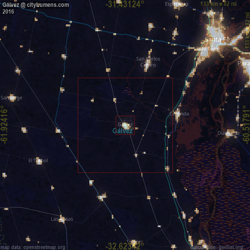
Analysis of Gálvez night lights 2016
Square area 10x10 km:
 1.57%
1.57%90-99
1.92%80-89
4.9%70-79
0.7%60-69
2.8%50-59
0.7%40-49
0%30-39
0.7%20-29
2.27%10-19
3.15%0-9
81.29%Square area 50x50 km:
0.09%90-99
0.12%80-89
0.48%70-79
0.13%60-69
0.31%50-59
0.09%40-49
0.2%30-39
0.27%20-29
0.12%10-19
0.16%0-9
98.04%Clear (daylight) street map image can be seen on geolist.org.
Map coordinates:
31° 25' 52.5" South, 61° 55' 27" West
32° 1' 45.4" South, 61° 13' 15.7" West
32° 37' 24.3" South, 60° 31' 4.5" West
Some cities around Gálvez sort by population:
• Santo Tomé
59.3 km =36.8 mi,  46°
46°
• Diamante
55.1 km =34.2 mi,  94°
94°
• Coronda
29.1 km =18.1 mi,  77°
77°
• San Jorge
62.1 km =38.6 mi,  283°
283°
• Las Rosas
60.1 km =37.3 mi,  214°
214°
• El Trébol
49.1 km =30.5 mi,  247°
247°
• San Carlos Centro
35.6 km =22.1 mi,  20°
20°
• Totoras
61.9 km =38.5 mi,  175°
175°
3855244 (p: 18,374)
Sources (retrieved 2019-11-25):
» Earth at Night: Flat Maps 2012, 2016