Cafayate night lights from space
Night Light of Cafayate (Salta) from space (Argentina) Src. Average luminocity for 10x10km area is 22.4881% and for 50x50km: 1.2633%.
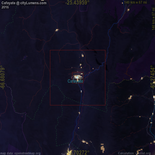
Analysis of Cafayate night lights 2016
Square area 10x10 km:
 1.98%
1.98%90-99
2.18%80-89
7.54%70-79
1.79%60-69
3.97%50-59
0.79%40-49
1.19%30-39
3.77%20-29
2.78%10-19
13.1%0-9
60.91%Square area 50x50 km:
0.08%90-99
0.09%80-89
0.4%70-79
0.16%60-69
0.16%50-59
0.06%40-49
0.14%30-39
0.21%20-29
0.14%10-19
0.61%0-9
97.97%Clear (daylight) street map image can be seen on geolist.org.
Map coordinates:
25° 26' 22.5" South, 66° 40' 50.8" West
26° 4' 22.3" South, 65° 58' 39.6" West
26° 42' 9.8" South, 65° 16' 28.3" West
Some cities around Cafayate sort by population:
• San Miguel de Tucumán
112.4 km =69.8 mi,  138°
138°
• Yerba Buena
105.7 km =65.7 mi, 141°
• Tafí Viejo
102.4 km =63.6 mi, 135°
• Alderetes
117.9 km =73.3 mi,  134°
134°
• Famaillá
123.2 km =76.6 mi,  152°
152°
• El Carril
121.3 km =75.4 mi,  23°
23°
• Chicoana
116.4 km =72.3 mi, 22°
• Trancas
71.7 km =44.6 mi,  104°
104°
3863503 (p: 11,785)
Sources (retrieved 2019-11-25):
» Earth at Night: Flat Maps 2012, 2016