Yerba Buena night lights from space
Night Light of Yerba Buena (Tucuman) from space (Argentina) Src. Average luminocity for 10x10km area is 60.2242% and for 50x50km: 20.0474%.
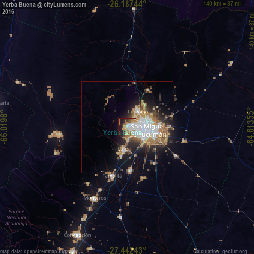
Analysis of Yerba Buena night lights 2016
Square area 10x10 km:
 15.28%
90-99
11.11%80-89
8.13%70-79
8.53%60-69
15.48%50-59
5.75%40-49
2.38%30-39
5.16%20-29
10.32%10-19
16.27%0-9
1.59%Square area 50x50 km:
4.36%90-99
3.16%80-89
1.88%70-79
2.47%60-69
4.07%50-59
2.11%40-49
2.4%30-39
2.94%20-29
4.76%10-19
8.83%0-9
63.02%Clear (daylight) street map image can be seen on geolist.org.
Map coordinates:
26° 11' 14.8" South, 66° 1' 11.3" West
26° 49' 0" South, 65° 19' 0" West
27° 26' 32.7" South, 64° 36' 48.8" West
Some cities around Yerba Buena sort by population:
• San Miguel de Tucumán
9.4 km =5.8 mi,  95°
95°
• Tafí Viejo
11 km =6.8 mi,  31°
31°
• Alderetes
18.2 km =11.3 mi,  90°
90°
• Famaillá
27.8 km =17.3 mi,  198°
198°
• Monteros
43 km =26.7 mi, 204°
• Bella Vista
24.2 km =15 mi,  176°
176°
• Simoca
49.8 km =30.9 mi, 184°
• Trancas
65.2 km =40.5 mi,  3°
3°
3832260 (p: 50,783)
Sources (retrieved 2019-11-25):
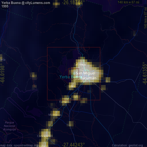
» NASA, Earths city lights 1995
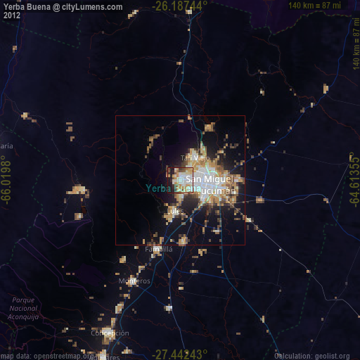
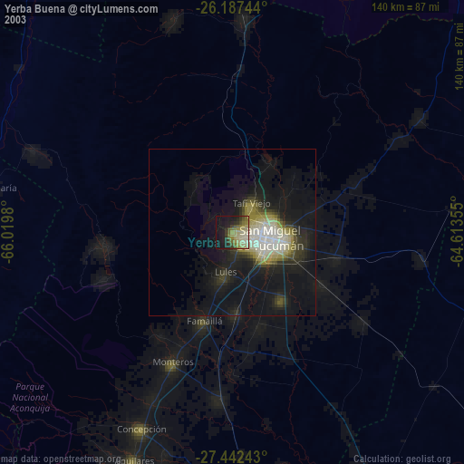
» NASA city lights 2003
» Earth at Night: Flat Maps 2012, 2016