Worcester night lights from space
Night Light of Worcester (Western Cape) from space (South Africa) Src. Average luminocity for 10x10km area is 48.859% and for 50x50km: 3.7452%.
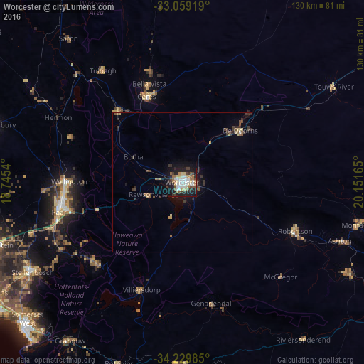
Analysis of Worcester night lights 2016
Square area 10x10 km:
 10.07%
90-99
10.44%80-89
6.59%70-79
3.48%60-69
7.69%50-59
6.78%40-49
5.13%30-39
7.51%20-29
12.64%10-19
27.66%0-9
2.01%Square area 50x50 km:
0.41%90-99
0.42%80-89
0.5%70-79
0.27%60-69
0.45%50-59
0.56%40-49
0.61%30-39
1.04%20-29
1.03%10-19
2.59%0-9
92.13%Clear (daylight) street map image can be seen on geolist.org.
Map coordinates:
33° 3' 33.1" South, 18° 44' 43.4" East
33° 38' 47.4" South, 19° 26' 54.7" East
34° 13' 47.5" South, 20° 9' 5.9" East
Some cities around Worcester sort by population:
• Paarl
44.8 km =27.8 mi,  257°
257°
• Stellenbosch
62.6 km =38.9 mi,  239°
239°
• Wellington
40.5 km =25.2 mi,  271°
271°
• Ceres
33.4 km =20.8 mi,  337°
337°
• Malmesbury
70 km =43.5 mi,  287°
287°
• Grabouw
68.9 km =42.8 mi,  215°
215°
• Robertson
44 km =27.3 mi,  113°
113°
• Montagu
64.1 km =39.8 mi,  104°
104°
3359041 (p: 127,597)
Sources (retrieved 2019-11-25):
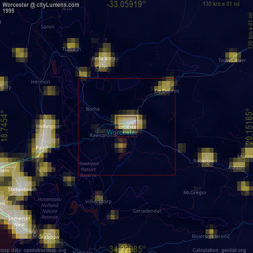
» NASA, Earths city lights 1995
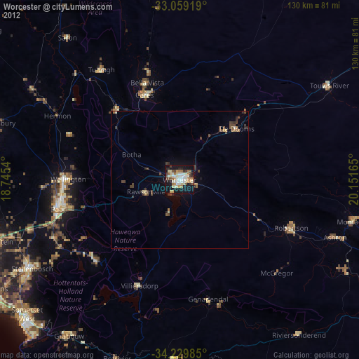
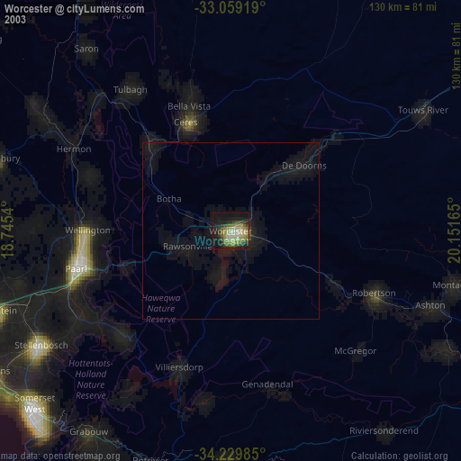
» NASA city lights 2003
» Earth at Night: Flat Maps 2012, 2016