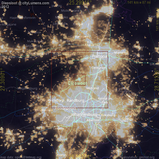
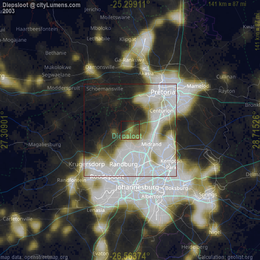
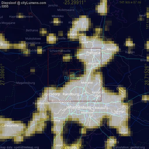
Diepsloot night lights from space
Night Light of Diepsloot (Gauteng) from space (South Africa) Src. Average luminocity for 10x10km area is 65.197% and for 50x50km: 67.865%.
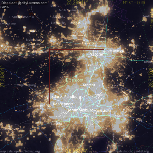
Analysis of Diepsloot night lights 2016
Square area 10x10 km:
 3.41%
3.41%90-99
3.41%80-89
7.77%70-79
36.74%60-69
22.54%50-59
6.63%40-49
5.87%30-39
6.44%20-29
6.06%10-19
1.14%0-9
0%Square area 50x50 km:
21.79%90-99
17.61%80-89
11.91%70-79
10.69%60-69
5.96%50-59
3.61%40-49
3.92%30-39
3.63%20-29
4.32%10-19
5.58%0-9
10.98%Clear (daylight) street map image can be seen on geolist.org.
Map coordinates:
25° 17' 56.8" South, 27° 18' 32.4" East
25° 55' 59.2" South, 28° 0' 43.7" East
26° 33' 49.5" South, 28° 42' 54.9" East
Some cities around Diepsloot sort by population:
• Tembisa
22.6 km =14 mi,  108°
108°
• Randburg
17.9 km =11.1 mi,  183°
183°
• Centurion
19.2 km =11.9 mi,  64°
64°
• Midrand
13.2 km =8.2 mi,  118°
118°
• Edenvale
27 km =16.8 mi,  148°
148°
• Midstream
18.7 km =11.6 mi,  85°
85°
• Eastleigh
26.1 km =16.2 mi, 146°
• Eden Glen Ext 60
26.3 km =16.3 mi,  144°
144°
8764562 (p: 350,000)
Sources (retrieved 2019-11-25):
» NASA, Earths city lights 1995
» NASA city lights 2003
» Earth at Night: Flat Maps 2012, 2016