Potchefstroom night lights from space
Night Light of Potchefstroom (North-West) from space (South Africa) Src. Average luminocity for 10x10km area is 59.6825% and for 50x50km: 5.3755%.
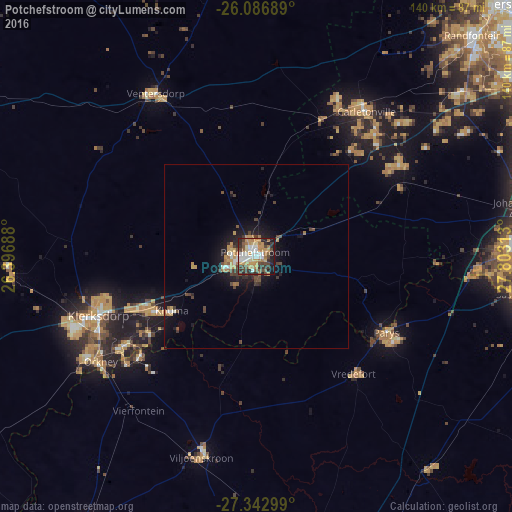

Analysis of Potchefstroom night lights 2016
Square area 10x10 km:
 9.33%
9.33%90-99
11.51%80-89
5.56%70-79
16.87%60-69
10.12%50-59
5.56%40-49
10.91%30-39
10.12%20-29
11.11%10-19
8.73%0-9
0.2%Square area 50x50 km:
0.48%90-99
0.71%80-89
0.3%70-79
1.36%60-69
0.79%50-59
0.45%40-49
1.25%30-39
0.93%20-29
1.16%10-19
3.93%0-9
88.64%Clear (daylight) street map image can be seen on geolist.org.
Map coordinates:
26° 5' 12.8" South, 26° 23' 48.8" East
26° 43' 0" South, 27° 6' 0" East
27° 20' 34.8" South, 27° 48' 11.3" East
Some cities around Potchefstroom sort by population:
• Carletonville
49.4 km =30.7 mi,  36°
36°
• Klerksdorp
45.6 km =28.3 mi,  250°
250°
• Orkney
51.5 km =32 mi,  235°
235°
• Stilfontein
35.9 km =22.3 mi, 246°
• Parys
41.1 km =25.5 mi,  120°
120°
• Fochville
46.7 km =29 mi,  57°
57°
• Viljoenskroon
56.7 km =35.2 mi,  195°
195°
• Vredefort
41.7 km =25.9 mi,  140°
140°
964349 (p: 123,669)
Sources (retrieved 2019-11-25):
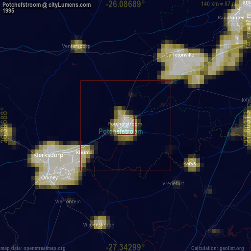
» NASA, Earths city lights 1995
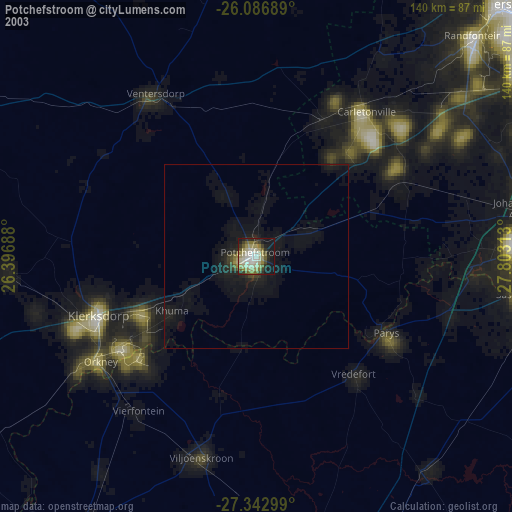
» NASA city lights 2003
» Earth at Night: Flat Maps 2012, 2016