Stilfontein night lights from space
Night Light of Stilfontein (North-West) from space (South Africa) Src. Average luminocity for 10x10km area is 31.4345% and for 50x50km: 11.3394%.
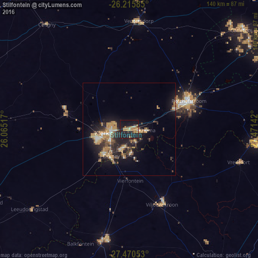
Analysis of Stilfontein night lights 2016
Square area 10x10 km:
 0.6%
0.6%90-99
1.59%80-89
3.17%70-79
11.71%60-69
6.75%50-59
0.79%40-49
3.57%30-39
3.17%20-29
6.75%10-19
53.57%0-9
8.33%Square area 50x50 km:
0.62%90-99
1.06%80-89
1.09%70-79
3.28%60-69
1.95%50-59
0.85%40-49
1.85%30-39
1.82%20-29
3.8%10-19
10.24%0-9
73.43%Clear (daylight) street map image can be seen on geolist.org.
Map coordinates:
26° 12' 57.1" South, 26° 3' 54.6" East
26° 50' 41.7" South, 26° 46' 5.8" East
27° 28' 13.9" South, 27° 28' 17.1" East
Some cities around Stilfontein sort by population:
• Klerksdorp
10.1 km =6.3 mi,  265°
265°
• Orkney
17.8 km =11.1 mi,  212°
212°
• Potchefstroom
35.9 km =22.3 mi,  66°
66°
• Bothaville
62.3 km =38.7 mi,  193°
193°
• Parys
68.6 km =42.6 mi,  95°
95°
• Fochville
82.3 km =51.1 mi,  61°
61°
• Viljoenskroon
44.2 km =27.5 mi,  156°
156°
• Vredefort
61.8 km =38.4 mi,  107°
107°
952192 (p: 93,110)
Sources (retrieved 2019-11-25):
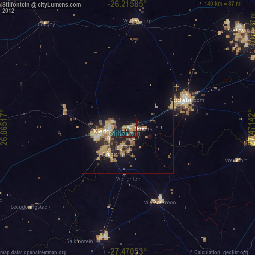
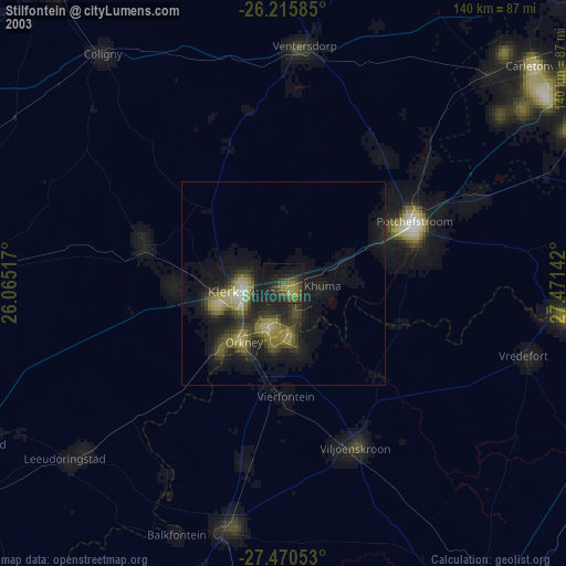
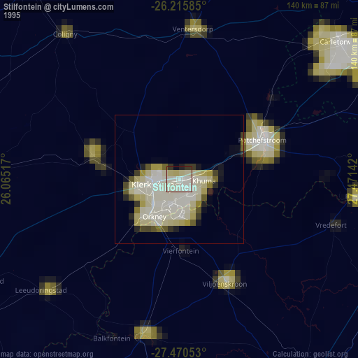
» NASA, Earths city lights 1995
» NASA city lights 2003
» Earth at Night: Flat Maps 2012, 2016