Carletonville night lights from space
Night Light of Carletonville (Gauteng) from space (South Africa) Src. Average luminocity for 10x10km area is 39% and for 50x50km: 10.3809%.
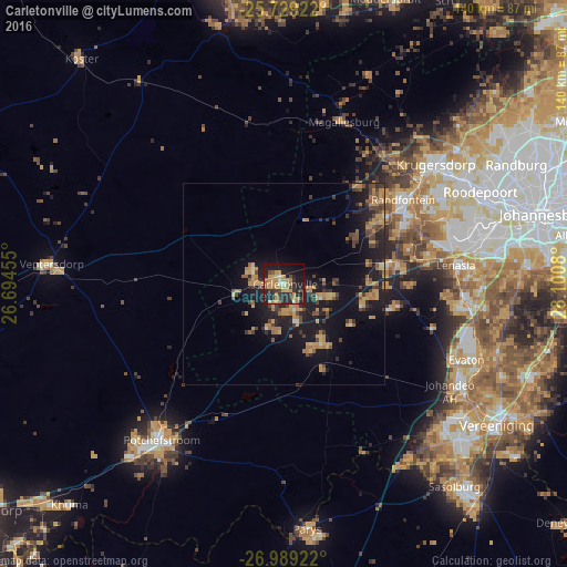
Analysis of Carletonville night lights 2016
Square area 10x10 km:
 1.52%
1.52%90-99
2.27%80-89
3.22%70-79
17.42%60-69
8.52%50-59
1.52%40-49
3.98%30-39
6.82%20-29
20.64%10-19
27.08%0-9
7.01%Square area 50x50 km:
0.19%90-99
0.29%80-89
0.85%70-79
3.23%60-69
2.22%50-59
0.98%40-49
2.18%30-39
1.57%20-29
3.65%10-19
11.03%0-9
73.82%Clear (daylight) street map image can be seen on geolist.org.
Map coordinates:
25° 43' 45.2" South, 26° 41' 40.4" East
26° 21' 39.4" South, 27° 23' 51.6" East
26° 59' 21.2" South, 28° 6' 2.9" East
Some cities around Carletonville sort by population:
• Soweto
47.1 km =29.3 mi,  77°
77°
• Krugersdorp
48.5 km =30.1 mi,  50°
50°
• Roodepoort
52.2 km =32.4 mi,  65°
65°
• Westonaria
25.4 km =15.8 mi, 79°
• Randfontein
36.1 km =22.4 mi,  57°
57°
• Potchefstroom
49.4 km =30.7 mi,  216°
216°
• Fochville
17.1 km =10.6 mi,  145°
145°
• Orange Farm
48.6 km =30.2 mi,  106°
106°
1014073 (p: 182,304)
Sources (retrieved 2019-11-25):
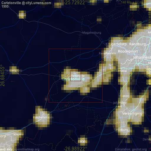
» NASA, Earths city lights 1995
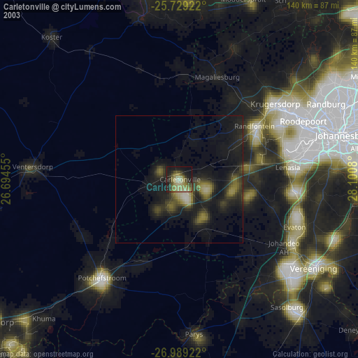
» NASA city lights 2003
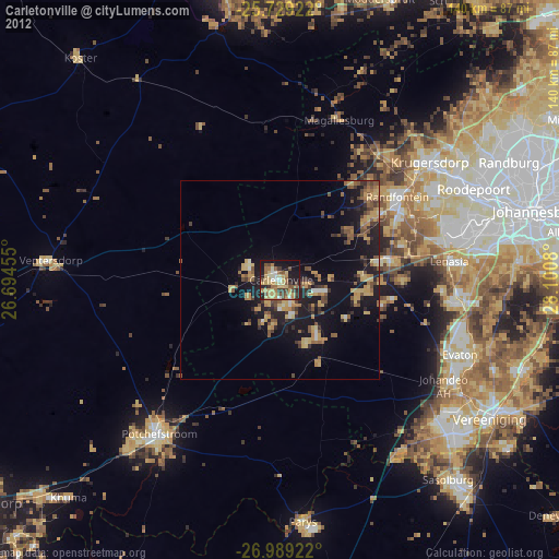
» Earth at Night: Flat Maps 2012, 2016