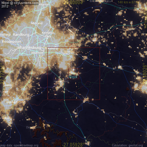
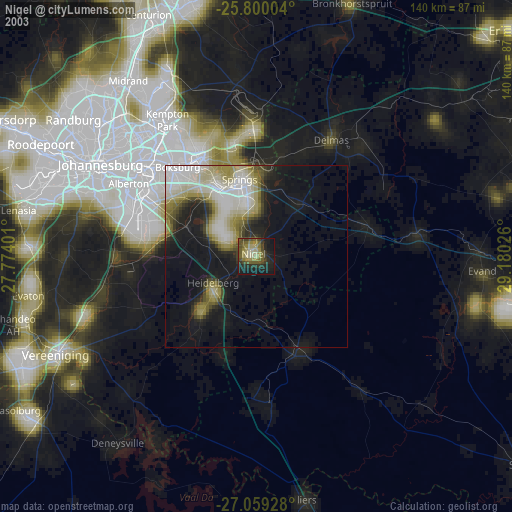
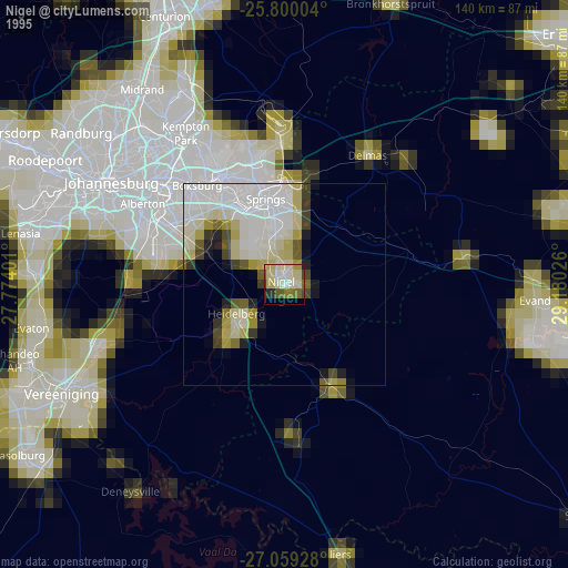
Nigel night lights from space
Night Light of Nigel (Gauteng) from space (South Africa) Src. Average luminocity for 10x10km area is 45.1837% and for 50x50km: 24.9883%.
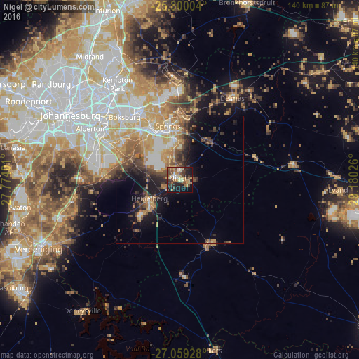
Analysis of Nigel night lights 2016
Square area 10x10 km:
 4.17%
4.17%90-99
4.17%80-89
6.82%70-79
10.42%60-69
7.77%50-59
7.39%40-49
10.61%30-39
9.09%20-29
13.26%10-19
22.92%0-9
3.41%Square area 50x50 km:
3.56%90-99
4.07%80-89
4.18%70-79
6.06%60-69
3.67%50-59
3.16%40-49
3.43%30-39
2.86%20-29
4.01%10-19
7.8%0-9
57.2%Clear (daylight) street map image can be seen on geolist.org.
Map coordinates:
25° 48' 0.1" South, 27° 46' 26.4" East
26° 25' 53" South, 28° 28' 37.7" East
27° 3' 33.4" South, 29° 10' 48.9" East
Some cities around Nigel sort by population:
• Benoni
31.2 km =19.4 mi,  330°
330°
• Boksburg
32.6 km =20.3 mi,  318°
318°
• Brakpan
24.2 km =15 mi, 333°
• Springs
21.6 km =13.4 mi,  339°
339°
• Alberton
39.8 km =24.7 mi,  297°
297°
• Delmas
37.7 km =23.4 mi,  32°
32°
• Heidelberg
14.3 km =8.9 mi,  235°
235°
• Balfour
28.1 km =17.5 mi,  156°
156°
970566 (p: 140,644)
Sources (retrieved 2019-11-25):
» NASA, Earths city lights 1995
» NASA city lights 2003
» Earth at Night: Flat Maps 2012, 2016