Springs night lights from space
Night Light of Springs (Gauteng) from space (South Africa) Src. Average luminocity for 10x10km area is 87.5218% and for 50x50km: 53.0367%.
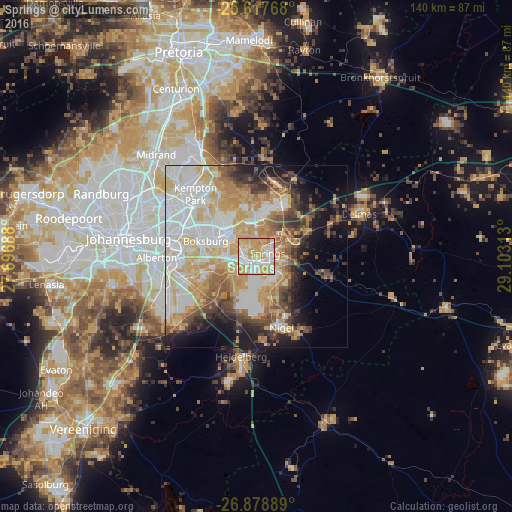

Analysis of Springs night lights 2016
Square area 10x10 km:
 21.63%
90-99
23.21%80-89
25.99%70-79
27.38%60-69
1.79%50-59
0%40-49
0%30-39
0%20-29
0%10-19
0%0-9
0%Square area 50x50 km:
12.35%90-99
11.6%80-89
9.56%70-79
10.44%60-69
5.7%50-59
4.5%40-49
5.67%30-39
4.71%20-29
5.47%10-19
10%0-9
20.02%Clear (daylight) street map image can be seen on geolist.org.
Map coordinates:
25° 37' 3.6" South, 27° 41' 48.8" East
26° 15' 0" South, 28° 24' 0" East
26° 52' 44" South, 29° 6' 11.3" East
Some cities around Springs sort by population:
• Benoni
10.5 km =6.5 mi,  310°
310°
• Boksburg
14.6 km =9.1 mi,  286°
286°
• Brakpan
3.4 km =2.1 mi,  296°
296°
• Nigel
21.6 km =13.4 mi,  159°
159°
• Alberton
27.8 km =17.3 mi,  265°
265°
• Edenvale
27.5 km =17.1 mi, 296°
• Eden Glen
26.5 km =16.5 mi, 299°
• Eden Glen Ext 60
27.2 km =16.9 mi, 300°
952865 (p: 186,394)
Sources (retrieved 2019-11-25):
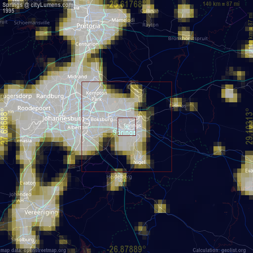
» NASA, Earths city lights 1995
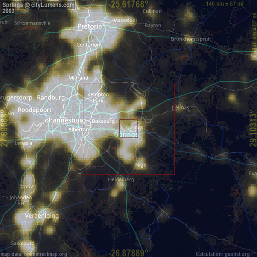
» NASA city lights 2003
» Earth at Night: Flat Maps 2012, 2016