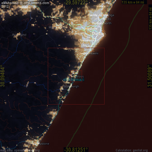
eMkhomazi night lights from space
Night Light of eMkhomazi (KwaZulu-Natal) from space (South Africa) Src. Average luminocity for 10x10km area is 18.6416% and for 50x50km: 7.2707%.
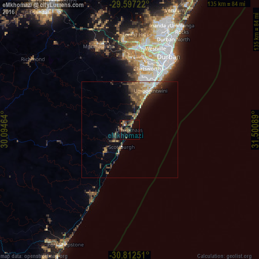
Analysis of eMkhomazi night lights 2016
Square area 10x10 km:
 0.35%
0.35%90-99
0.35%80-89
1.05%70-79
3.85%60-69
2.1%50-59
6.99%40-49
5.94%30-39
3.5%20-29
2.45%10-19
13.99%0-9
59.44%Square area 50x50 km:
0.58%90-99
0.85%80-89
0.62%70-79
0.9%60-69
1.07%50-59
1.94%40-49
1.7%30-39
1.5%20-29
1.52%10-19
4.1%0-9
85.22%Clear (daylight) street map image can be seen on geolist.org.
Map coordinates:
29° 35' 50" South, 30° 5' 40.7" East
30° 12' 24.3" South, 30° 47' 51.9" East
30° 48' 45" South, 31° 30' 3.2" East
Some cities around eMkhomazi sort by population:
• Durban
44.7 km =27.8 mi,  29°
29°
• Pietermaritzburg
76.3 km =47.4 mi,  329°
329°
• Mpumalanga
46.5 km =28.9 mi,  340°
340°
• Port Shepstone
67.9 km =42.2 mi,  208°
208°
• Margate
83.7 km =52 mi, 209°
• Richmond
62.8 km =39 mi,  306°
306°
• Scottburgh
9.9 km =6.2 mi, 205°
• Berea
43.7 km =27.2 mi, 25°
946128 (p: 20,410)
Sources (retrieved 2019-11-25):
» Earth at Night: Flat Maps 2012, 2016