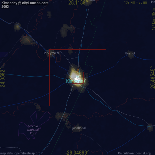
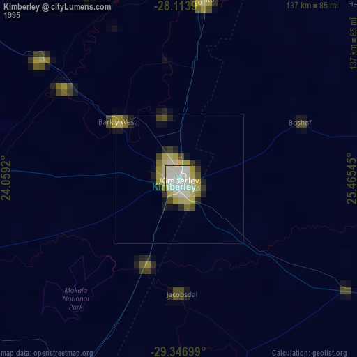
Kimberley night lights from space
Night Light of Kimberley (Northern Cape) from space (South Africa) Src. Average luminocity for 10x10km area is 72.608% and for 50x50km: 5.6018%.
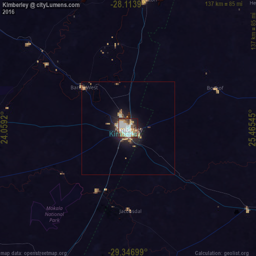

Analysis of Kimberley night lights 2016
Square area 10x10 km:
 21.78%
90-99
22.73%80-89
5.11%70-79
14.77%60-69
3.79%50-59
3.98%40-49
9.47%30-39
6.82%20-29
6.82%10-19
4.73%0-9
0%Square area 50x50 km:
0.96%90-99
1.08%80-89
0.46%70-79
1.24%60-69
0.49%50-59
0.31%40-49
0.76%30-39
0.69%20-29
1.61%10-19
3.57%0-9
88.84%Clear (daylight) street map image can be seen on geolist.org.
Map coordinates:
28° 6' 50" South, 24° 3' 33.1" East
28° 43' 56.1" South, 24° 45' 44.4" East
29° 20' 49.2" South, 25° 27' 55.6" East
Some cities around Kimberley sort by population:
• Pampierstad
105.8 km =65.7 mi,  356°
356°
• Warrenton
69.3 km =43.1 mi,  6°
6°
• Christiana
99 km =61.5 mi,  23°
23°
• Bloemhof
146.3 km =90.9 mi,  34°
34°
• Jan Kempdorp
90.3 km =56.1 mi,  4°
4°
• Barkly West
32.1 km =19.9 mi,  312°
312°
• Daniëlskuil
133.9 km =83.2 mi,  296°
296°
• Ritchie
37.4 km =23.2 mi,  204°
204°
990930 (p: 142,089)
Sources (retrieved 2019-11-25):
» NASA, Earths city lights 1995
» NASA city lights 2003
» Earth at Night: Flat Maps 2012, 2016