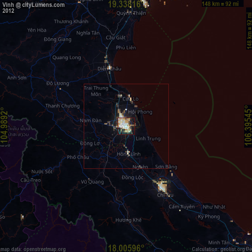
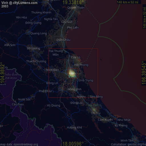
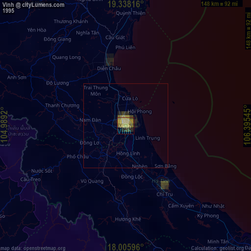
Vinh night lights from space
Night Light of Vinh (Nghệ An) from space (Vietnam) Src. Average luminocity for 10x10km area is 64.093% and for 50x50km: 5.7687%.
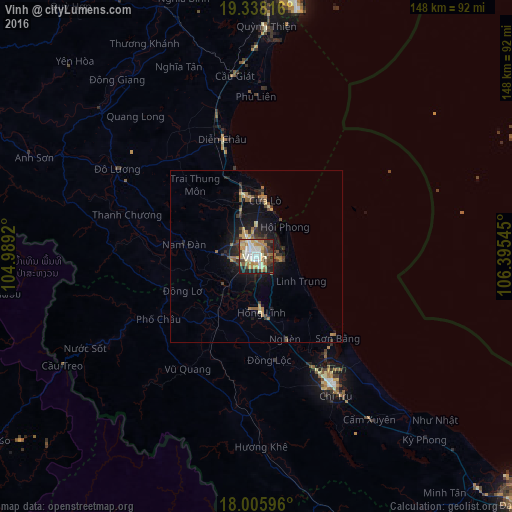
Analysis of Vinh night lights 2016
Square area 10x10 km:
 12.4%
12.4%90-99
13.02%80-89
10.54%70-79
13.43%60-69
11.16%50-59
4.55%40-49
9.5%30-39
6.61%20-29
11.36%10-19
7.44%0-9
0%Square area 50x50 km:
0.5%90-99
0.54%80-89
0.74%70-79
1.1%60-69
1%50-59
0.72%40-49
0.78%30-39
1.05%20-29
1.54%10-19
4.27%0-9
87.75%Clear (daylight) street map image can be seen on geolist.org.
Map coordinates:
19° 20' 17.4" North, 104° 59' 21.1" East
18° 40' 24.1" North, 105° 41' 32.4" East
18° 0' 21.5" North, 106° 23' 43.6" East
Some cities around Vinh sort by population:
• Thanh Hóa
125.5 km =78 mi,  3°
3°
• Yên Vinh
2.8 km =1.7 mi,  254°
254°
• Thakhèk, LA
167.4 km =104 mi,  212°
212°
• Bỉm Sơn
157.2 km =97.7 mi,  6°
6°
• Ninh Bình
178.8 km =111.1 mi, 9°
• Nakhon Phanom, TH
170.4 km =105.9 mi, 214°
• Kwang Binh
166.1 km =103.2 mi,  143°
143°
• Hà Tĩnh
43.1 km =26.8 mi,  148°
148°
1562798 (p: 163,759)
Sources (retrieved 2019-11-25):
» NASA, Earths city lights 1995
» NASA city lights 2003
» Earth at Night: Flat Maps 2012, 2016