Hà Tĩnh night lights from space
Night Light of Hà Tĩnh from space (Vietnam) Src. Average luminocity for 10x10km area is 36.2025% and for 50x50km: 2.5028%.
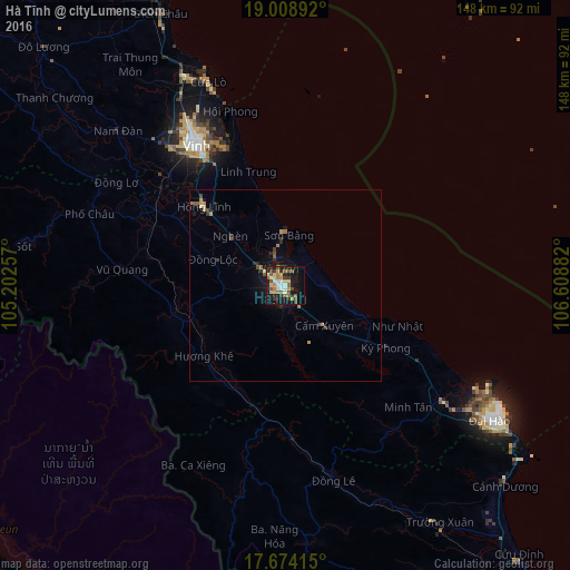
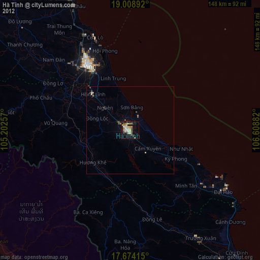
Analysis of Hà Tĩnh night lights 2016
Square area 10x10 km:
 3.51%
3.51%90-99
4.75%80-89
6.4%70-79
5.58%60-69
5.58%50-59
6.4%40-49
6.4%30-39
4.96%20-29
5.99%10-19
30.58%0-9
19.83%Square area 50x50 km:
0.14%90-99
0.19%80-89
0.31%70-79
0.43%60-69
0.43%50-59
0.45%40-49
0.37%30-39
0.47%20-29
0.46%10-19
2.2%0-9
94.54%Clear (daylight) street map image can be seen on geolist.org.
Map coordinates:
19° 0' 32.1" North, 105° 12' 9.3" East
18° 20' 34.2" North, 105° 54' 20.5" East
17° 40' 26.9" North, 106° 36' 31.8" East
Some cities around Hà Tĩnh sort by population:
• Vinh
43.1 km =26.8 mi,  328°
328°
• Thanh Hóa
162.7 km =101.1 mi,  354°
354°
• Yên Vinh
44 km =27.3 mi, 325°
• Thakhèk, LA
153.9 km =95.6 mi,  227°
227°
• Bỉm Sơn
193 km =119.9 mi,  358°
358°
• Nakhon Phanom, TH
158 km =98.2 mi, 229°
• Kwang Binh
123.3 km =76.6 mi,  142°
142°
• That Phanom, TH
201.2 km =125 mi,  219°
219°
1581047 (p: 27,728)
Sources (retrieved 2019-11-25):
» Earth at Night: Flat Maps 2012, 2016