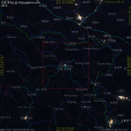
Cao Bằng night lights from space
Night Light of Cao Bằng from space (Vietnam) Src. Average luminocity for 10x10km area is 3.3135% and for 50x50km: 0.1687%.
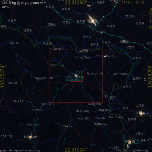
Analysis of Cao Bằng night lights 2016
Square area 10x10 km:
 0%
0%90-99
0%80-89
0%70-79
0.79%60-69
0.4%50-59
0.79%40-49
1.98%30-39
0.99%20-29
1.39%10-19
0.79%0-9
92.86%Square area 50x50 km:
0%90-99
0%80-89
0%70-79
0.03%60-69
0.02%50-59
0.1%40-49
0.08%30-39
0.04%20-29
0.06%10-19
0.03%0-9
99.65%Clear (daylight) street map image can be seen on geolist.org.
Map coordinates:
23° 18' 46.7" North, 105° 33' 17.1" East
22° 39' 56.4" North, 106° 15' 28.3" East
22° 0' 55.2" North, 106° 57' 39.6" East
Some cities around Cao Bằng sort by population:
• Thái Nguyên
126.4 km =78.5 mi,  199°
199°
• Baise City, CN
141.9 km =88.2 mi,  14°
14°
• Baihe, CN
116.3 km =72.3 mi,  120°
120°
• Lạng Sơn
104.2 km =64.7 mi,  150°
150°
• Bắc Giang
155 km =96.3 mi,  182°
182°
• Tuyên Quang
142.5 km =88.5 mi,  228°
228°
• Hà Giang
131.8 km =81.9 mi,  277°
277°
• Bắc Kạn
72.2 km =44.9 mi,  217°
217°
1586185 (p: 41,112)
Sources (retrieved 2019-11-25):
» Earth at Night: Flat Maps 2012, 2016