Baihe night lights from space
Night Light of Baihe (Guangxi) from space (China) Src. Average luminocity for 10x10km area is 0% and for 50x50km: 1.1602%.
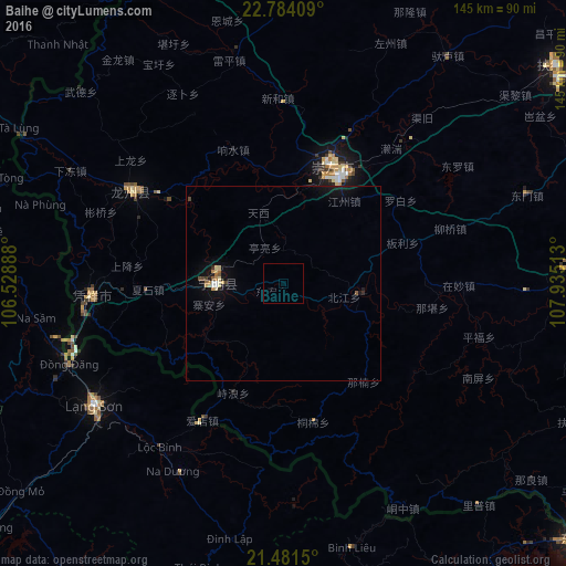
Analysis of Baihe night lights 2016
Square area 10x10 km:
 0%
0%90-99
0%80-89
0%70-79
0%60-69
0%50-59
0%40-49
0%30-39
0%20-29
0%10-19
0%0-9
100%Square area 50x50 km:
0.09%90-99
0.07%80-89
0.26%70-79
0.09%60-69
0.11%50-59
0.16%40-49
0.13%30-39
0.05%20-29
0.17%10-19
1.12%0-9
97.76%Clear (daylight) street map image can be seen on geolist.org.
Map coordinates:
22° 47' 2.7" North, 106° 31' 44" East
22° 8' 3.5" North, 107° 13' 55.2" East
21° 28' 53.4" North, 107° 56' 6.5" East
Some cities around Baihe sort by population:
• Nanning
134.8 km =83.8 mi,  55°
55°
• Hạ Long, VN
132.7 km =82.5 mi,  187°
187°
• Cẩm Phả Mines, VN
124.5 km =77.4 mi,  176°
176°
• Móng Cái, VN
101.7 km =63.2 mi,  131°
131°
• Thành Phố Uông Bí, VN
131.3 km =81.6 mi,  201°
201°
• Lạng Sơn, VN
57.8 km =35.9 mi,  237°
237°
• Bắc Giang, VN
143.7 km =89.3 mi,  228°
228°
• Cao Bằng, VN
116.3 km =72.3 mi,  300°
300°
1817701 (p: 63,629)
Sources (retrieved 2019-11-25):
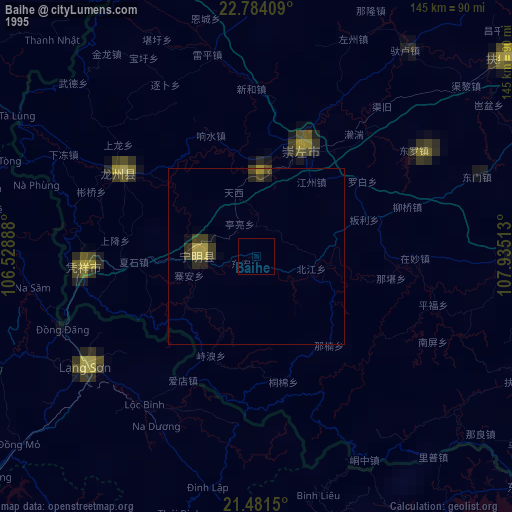
» NASA, Earths city lights 1995
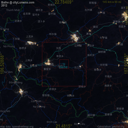
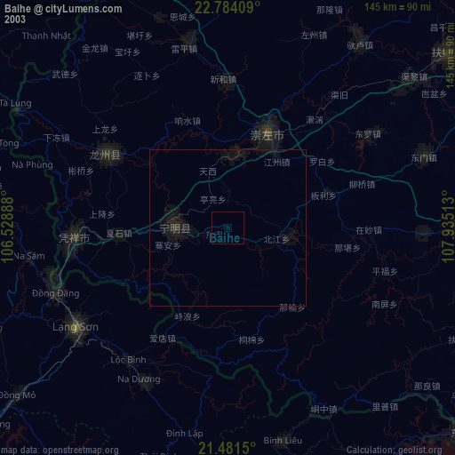
» NASA city lights 2003
» Earth at Night: Flat Maps 2012, 2016