San Fernando night lights from space
Night Light of San Fernando from space (Trinidad and Tobago) Src. Average luminocity for 10x10km area is 71.2107% and for 50x50km: 37.7735%.
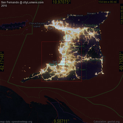
Analysis of San Fernando night lights 2016
Square area 10x10 km:
 25%
25%90-99
22.73%80-89
12.6%70-79
1.65%60-69
1.45%50-59
4.75%40-49
3.31%30-39
8.88%20-29
13.02%10-19
6.61%0-9
0%Square area 50x50 km:
3.23%90-99
6.36%80-89
13.69%70-79
4.06%60-69
4.45%50-59
4.39%40-49
4.7%30-39
5.06%20-29
8.87%10-19
12.95%0-9
32.23%Clear (daylight) street map image can be seen on geolist.org.
Map coordinates:
10° 58' 14.7" North, 62° 10' 17.3" West
10° 16' 46.9" North, 61° 28' 6.1" West
9° 35' 13.6" North, 60° 45' 54.8" West
Some cities around San Fernando sort by population:
• Chaguanas
26.9 km =16.7 mi,  12°
12°
• Mon Repos
2.5 km =1.6 mi,  89°
89°
• Marabella
3.8 km =2.4 mi,  38°
38°
• Point Fortin
26.4 km =16.4 mi,  243°
243°
• Peñal
12.6 km =7.8 mi,  179°
179°
• Princes Town
10.7 km =6.6 mi, 94°
• Siparia
15.5 km =9.6 mi,  195°
195°
• Couva
15.9 km =9.9 mi,  0°
0°
3573738 (p: 55,419)
Sources (retrieved 2019-11-25):
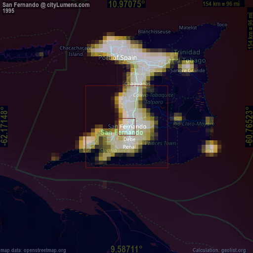
» NASA, Earths city lights 1995
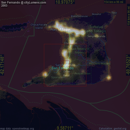
» NASA city lights 2003
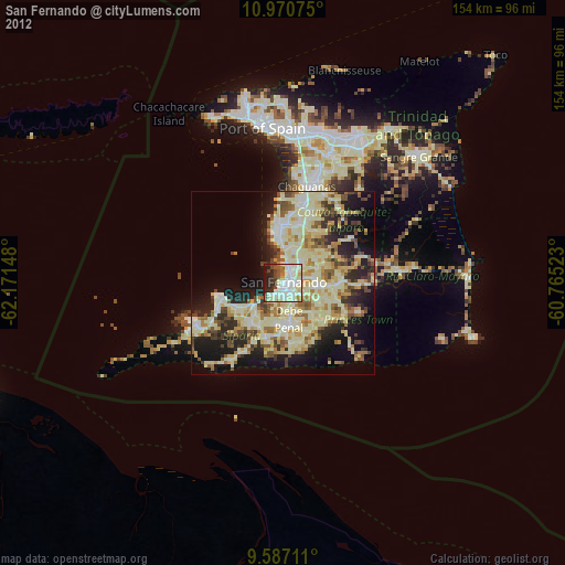
» Earth at Night: Flat Maps 2012, 2016