Peñal night lights from space
Night Light of Peñal (Penal/Debe) from space (Trinidad and Tobago) Src. Average luminocity for 10x10km area is 78.1467% and for 50x50km: 29.9287%.
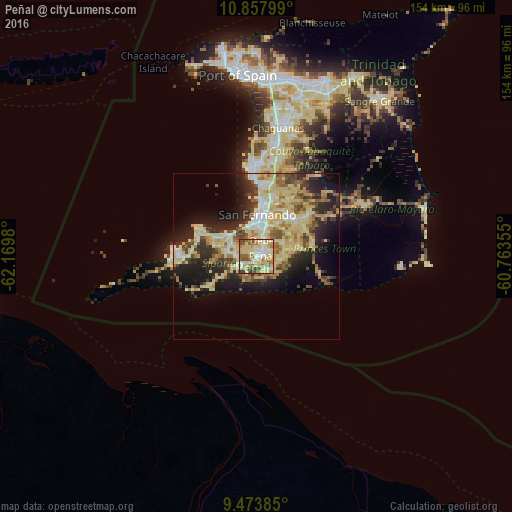
Analysis of Peñal night lights 2016
Square area 10x10 km:
 4.96%
4.96%90-99
20.66%80-89
35.74%70-79
9.71%60-69
9.92%50-59
10.95%40-49
6.2%30-39
1.86%20-29
0%10-19
0%0-9
0%Square area 50x50 km:
2.31%90-99
4.82%80-89
10.93%70-79
3.29%60-69
3.79%50-59
3.52%40-49
3.65%30-39
3.91%20-29
7.49%10-19
10.51%0-9
45.77%Clear (daylight) street map image can be seen on geolist.org.
Map coordinates:
10° 51' 28.8" North, 62° 10' 11.3" West
10° 10' 0" North, 61° 28' 0" West
9° 28' 25.9" North, 60° 45' 48.8" West
Some cities around Peñal sort by population:
• Mon Repos
12.8 km =8 mi,  10°
10°
• San Fernando
12.6 km =7.8 mi,  359°
359°
• Rio Claro
35.4 km =22 mi,  64°
64°
• Marabella
15.7 km =9.8 mi, 8°
• Point Fortin
23.8 km =14.8 mi,  271°
271°
• Princes Town
15.7 km =9.8 mi,  41°
41°
• Siparia
5.1 km =3.2 mi,  241°
241°
• Couva
28.4 km =17.6 mi, 359°
3573965 (p: 12,281)
Sources (retrieved 2019-11-25):
» Earth at Night: Flat Maps 2012, 2016