Puerto La Cruz night lights from space
Night Light of Puerto La Cruz (Anzoátegui) from space (Venezuela) Src. Average luminocity for 10x10km area is 78.0764% and for 50x50km: 19.0218%.
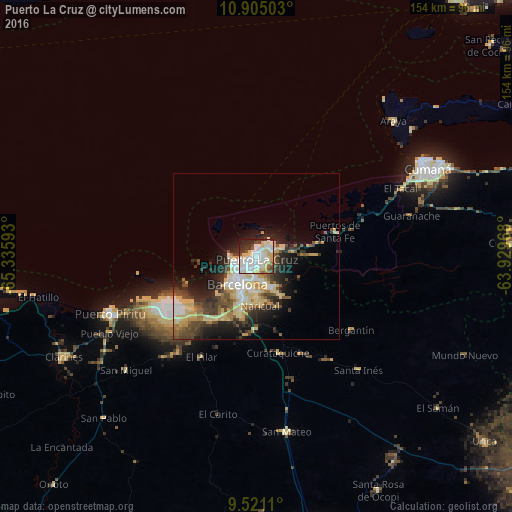
Analysis of Puerto La Cruz night lights 2016
Square area 10x10 km:
 27.27%
90-99
26.45%80-89
15.91%70-79
3.1%60-69
1.65%50-59
2.89%40-49
4.55%30-39
6.61%20-29
8.88%10-19
2.69%0-9
0%Square area 50x50 km:
2.89%90-99
3.27%80-89
5.11%70-79
1.46%60-69
1.7%50-59
1.79%40-49
3.48%30-39
3.07%20-29
4.84%10-19
7.98%0-9
64.41%Clear (daylight) street map image can be seen on geolist.org.
Map coordinates:
10° 54' 18.1" North, 65° 20' 9.3" West
10° 12' 49.8" North, 64° 37' 58.1" West
9° 31' 16" North, 63° 55' 46.8" West
Some cities around Puerto La Cruz sort by population:
• Barcelona
10.4 km =6.5 mi,  214°
214°
• Cumaná
56 km =34.8 mi,  61°
61°
• Anaco
89.1 km =55.4 mi,  168°
168°
• Porlamar
117.5 km =73 mi,  45°
45°
• Zaraza
122.3 km =76 mi,  218°
218°
• La Asunción
124 km =77.1 mi,  42°
42°
• Cantaura
105.4 km =65.5 mi,  163°
163°
• Juan Griego
121 km =75.2 mi, 37°
3629672 (p: 370,000)
Sources (retrieved 2019-11-25):
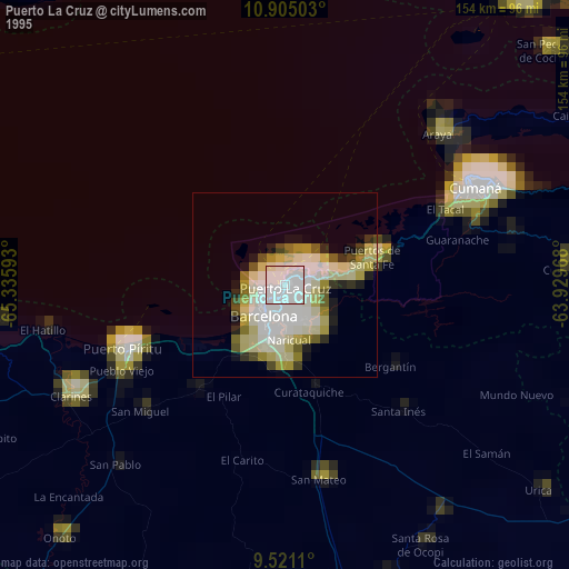
» NASA, Earths city lights 1995
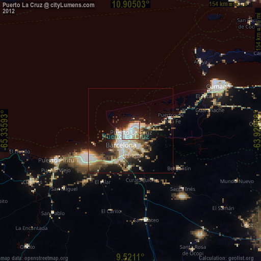
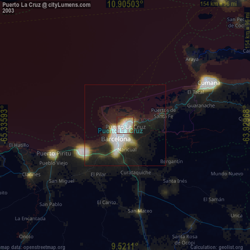
» NASA city lights 2003
» Earth at Night: Flat Maps 2012, 2016