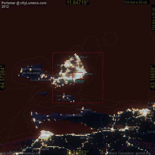
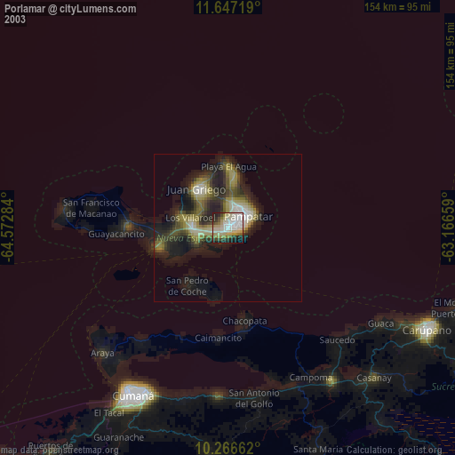
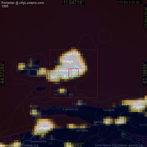
Porlamar night lights from space
Night Light of Porlamar (Nueva Esparta) from space (Venezuela) Src. Average luminocity for 10x10km area is 66.1926% and for 50x50km: 17.1927%.
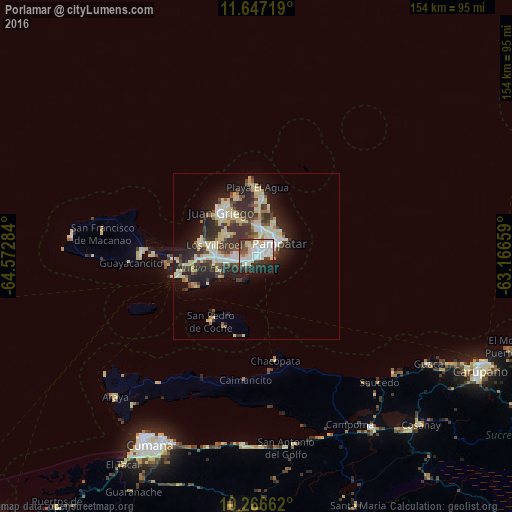
Analysis of Porlamar night lights 2016
Square area 10x10 km:
 20.35%
90-99
21.65%80-89
9.96%70-79
1.52%60-69
2.81%50-59
4.76%40-49
6.28%30-39
9.52%20-29
15.15%10-19
7.79%0-9
0.22%Square area 50x50 km:
2.17%90-99
3.3%80-89
4.68%70-79
1.1%60-69
0.87%50-59
1.41%40-49
2.59%30-39
4.35%20-29
5.34%10-19
8.41%0-9
65.79%Clear (daylight) street map image can be seen on geolist.org.
Map coordinates:
11° 38' 49.9" North, 64° 34' 22.2" West
10° 57' 27.8" North, 63° 52' 11" West
10° 15' 59.8" North, 63° 9' 59.7" West
Some cities around Porlamar sort by population:
• Barcelona
127.7 km =79.3 mi,  224°
224°
• Maturín
154.3 km =95.9 mi,  150°
150°
• Puerto La Cruz
117.5 km =73 mi,  225°
225°
• Cumaná
65.6 km =40.8 mi,  211°
211°
• Carúpano
74.7 km =46.4 mi,  115°
115°
• Güiria
176.8 km =109.9 mi,  103°
103°
• La Asunción
8.4 km =5.2 mi,  5°
5°
• Juan Griego
17.3 km =10.7 mi,  322°
322°
3629965 (p: 87,120)
Sources (retrieved 2019-11-25):
» NASA, Earths city lights 1995
» NASA city lights 2003
» Earth at Night: Flat Maps 2012, 2016