El Limón night lights from space
Night Light of El Limón (Aragua) from space (Venezuela) Src. Average luminocity for 10x10km area is 44.0041% and for 50x50km: 21.1711%.
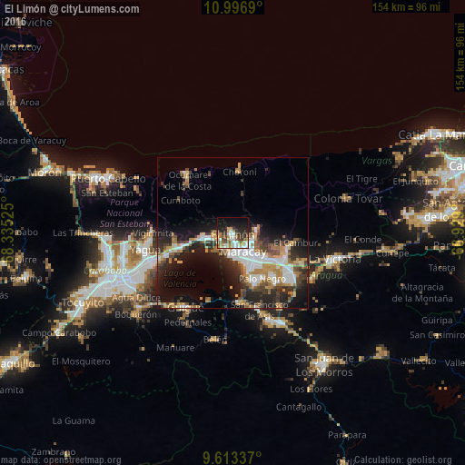
Analysis of El Limón night lights 2016
Square area 10x10 km:
 8.06%
8.06%90-99
7.85%80-89
2.27%70-79
7.23%60-69
9.3%50-59
5.58%40-49
4.96%30-39
7.64%20-29
12.81%10-19
20.66%0-9
13.64%Square area 50x50 km:
3.75%90-99
3.72%80-89
1.16%70-79
3.86%60-69
3.17%50-59
2.34%40-49
3.01%30-39
3.71%20-29
6.64%10-19
11.02%0-9
57.61%Clear (daylight) street map image can be seen on geolist.org.
Map coordinates:
10° 59' 48.8" North, 68° 20' 6.9" West
10° 18' 21.2" North, 67° 37' 55.6" West
9° 36' 48.1" North, 66° 55' 44.4" West
Some cities around El Limón sort by population:
• Maracay
9 km =5.6 mi,  150°
150°
• Turmero
19.3 km =12 mi,  116°
116°
• Guacara
28.2 km =17.5 mi,  251°
251°
• Palo Negro
17.7 km =11 mi, 146°
• Cagua
23.1 km =14.4 mi,  125°
125°
• Mariara
9.4 km =5.8 mi,  262°
262°
• San Mateo
25 km =15.5 mi,  114°
114°
• San Joaquín
18.4 km =11.4 mi, 254°
3642833 (p: 148,247)
Sources (retrieved 2019-11-25):
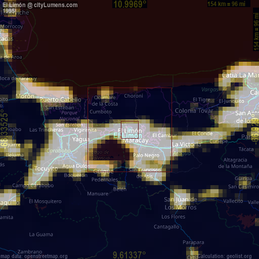
» NASA, Earths city lights 1995
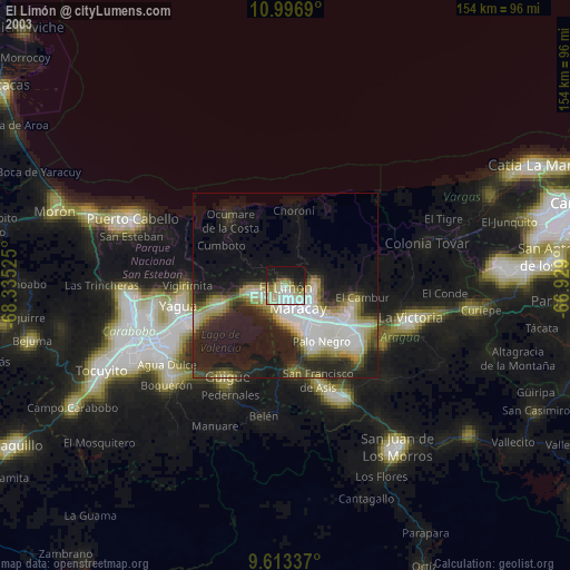
» NASA city lights 2003
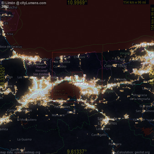
» Earth at Night: Flat Maps 2012, 2016