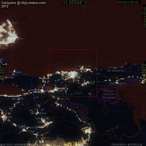
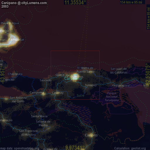
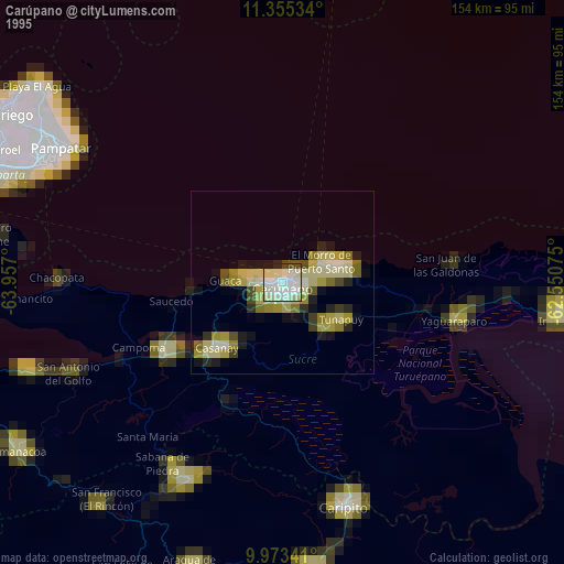
Carúpano night lights from space
Night Light of Carúpano (Sucre) from space (Venezuela) Src. Average luminocity for 10x10km area is 48.9194% and for 50x50km: 5.9937%.
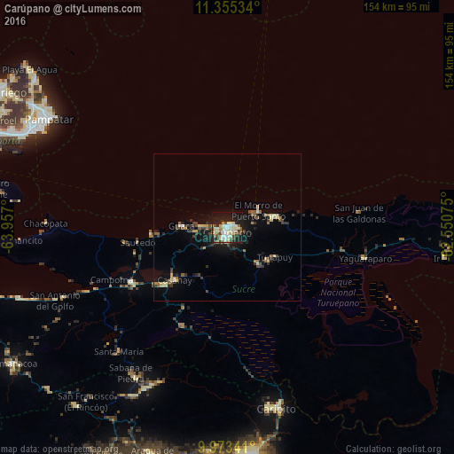
Analysis of Carúpano night lights 2016
Square area 10x10 km:
 6.61%
6.61%90-99
14.46%80-89
11.78%70-79
3.51%60-69
4.13%50-59
1.65%40-49
7.85%30-39
4.96%20-29
9.71%10-19
30.58%0-9
4.75%Square area 50x50 km:
0.34%90-99
0.77%80-89
1.25%70-79
0.48%60-69
0.51%50-59
0.74%40-49
0.93%30-39
1.46%20-29
0.97%10-19
4.78%0-9
87.77%Clear (daylight) street map image can be seen on geolist.org.
Map coordinates:
11° 21' 19.2" North, 63° 57' 25.2" West
10° 39' 54.6" North, 63° 15' 13.9" West
9° 58' 24.3" North, 62° 33' 2.7" West
Some cities around Carúpano sort by population:
• Barcelona
167.3 km =104 mi,  249°
249°
• Maturín
102.5 km =63.7 mi,  175°
175°
• Puerto La Cruz
158.9 km =98.7 mi, 251°
• Cumaná
104.2 km =64.7 mi,  256°
256°
• Porlamar
74.7 km =46.4 mi,  295°
295°
• Güiria
104.9 km =65.2 mi,  95°
95°
• La Asunción
78.1 km =48.5 mi, 301°
• Juan Griego
90.5 km =56.2 mi, 300°
3646382 (p: 112,082)
Sources (retrieved 2019-11-25):
» NASA, Earths city lights 1995
» NASA city lights 2003
» Earth at Night: Flat Maps 2012, 2016