Catia La Mar night lights from space
Night Light of Catia La Mar (Vargas) from space (Venezuela) Src. Average luminocity for 10x10km area is 41.0764% and for 50x50km: 20.246%.
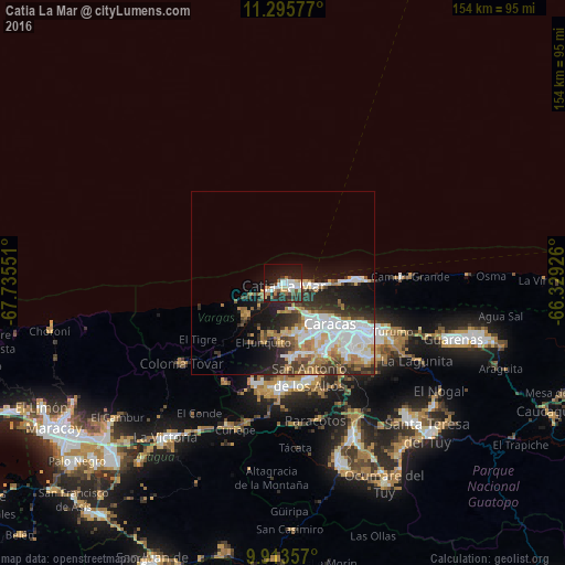
Analysis of Catia La Mar night lights 2016
Square area 10x10 km:
 8.47%
8.47%90-99
9.3%80-89
3.93%70-79
1.86%60-69
5.99%50-59
4.96%40-49
5.17%30-39
4.55%20-29
14.88%10-19
28.51%0-9
12.4%Square area 50x50 km:
5.37%90-99
3.86%80-89
1.7%70-79
2.19%60-69
3.27%50-59
1.68%40-49
2.01%30-39
3.27%20-29
5.22%10-19
8.61%0-9
62.82%Clear (daylight) street map image can be seen on geolist.org.
Map coordinates:
11° 17' 44.8" North, 67° 44' 7.8" West
10° 36' 19.6" North, 67° 1' 56.6" West
9° 54' 48.9" North, 66° 19' 45.3" West
Some cities around Catia La Mar sort by population:
• Caracas
21.2 km =13.2 mi,  127°
127°
• Baruta
25.6 km =15.9 mi,  137°
137°
• Chacao
23 km =14.3 mi,  121°
121°
• San Antonio de Los Altos
25.7 km =16 mi,  159°
159°
• Los Dos Caminos
25.5 km =15.8 mi, 119°
• Maiquetía
8.4 km =5.2 mi,  98°
98°
• Caraballeda
19.7 km =12.2 mi,  87°
87°
• La Guaira
10.9 km =6.8 mi, 92°
3646190 (p: 106,822)
Sources (retrieved 2019-11-25):
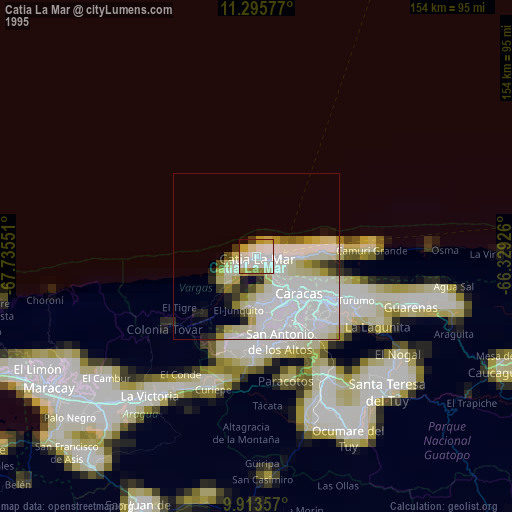
» NASA, Earths city lights 1995
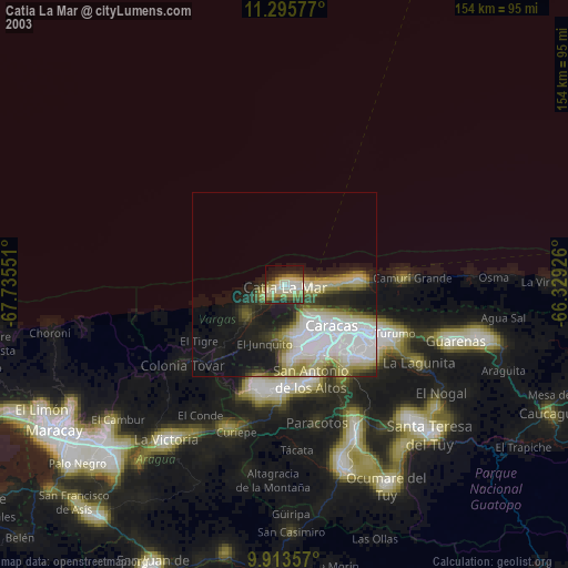
» NASA city lights 2003
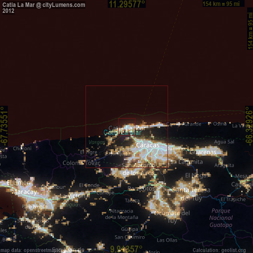
» Earth at Night: Flat Maps 2012, 2016