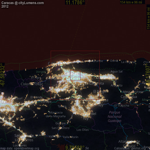
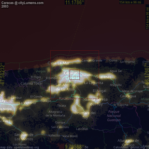
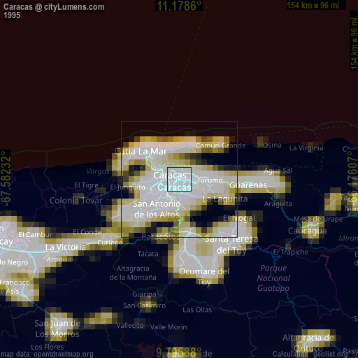
Caracas night lights from space
Night Light of Caracas (Distrito Federal) from space (Venezuela) Src. Average luminocity for 10x10km area is 88.9339% and for 50x50km: 31.5682%.
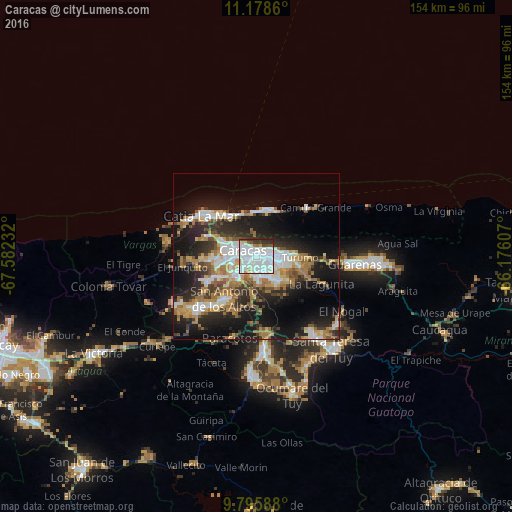
Analysis of Caracas night lights 2016
Square area 10x10 km:
 51.24%
90-99
25.41%80-89
4.96%70-79
2.48%60-69
1.45%50-59
2.27%40-49
3.51%30-39
6.61%20-29
2.07%10-19
0%0-9
0%Square area 50x50 km:
6.64%90-99
5.26%80-89
2.72%70-79
4.12%60-69
6.46%50-59
2.57%40-49
3.11%30-39
5.11%20-29
9.08%10-19
18.88%0-9
36.06%Clear (daylight) street map image can be seen on geolist.org.
Map coordinates:
11° 10' 43" North, 67° 34' 56.4" West
10° 29' 16.8" North, 66° 52' 45.1" West
9° 47' 45.2" North, 66° 10' 33.9" West
Some cities around Caracas sort by population:
• Petare
7.9 km =4.9 mi,  99°
99°
• Baruta
6 km =3.7 mi,  176°
176°
• El Cafetal
6 km =3.7 mi,  114°
114°
• Chacao
2.9 km =1.8 mi,  72°
72°
• San Antonio de Los Altos
13.6 km =8.5 mi,  215°
215°
• Los Dos Caminos
5.6 km =3.5 mi,  83°
83°
• El Hatillo
9.2 km =5.7 mi,  140°
140°
• La Dolorita
10.2 km =6.3 mi,  89°
89°
3646738 (p: 3,000,000)
Sources (retrieved 2019-11-25):
» NASA, Earths city lights 1995
» NASA city lights 2003
» Earth at Night: Flat Maps 2012, 2016