Chacao night lights from space
Night Light of Chacao (Miranda) from space (Venezuela) Src. Average luminocity for 10x10km area is 78.9421% and for 50x50km: 30.6558%.
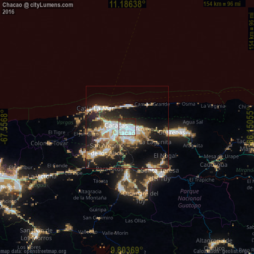
Analysis of Chacao night lights 2016
Square area 10x10 km:
 47.52%
90-99
18.39%80-89
1.86%70-79
1.45%60-69
2.69%50-59
2.07%40-49
3.1%30-39
10.12%20-29
11.16%10-19
1.65%0-9
0%Square area 50x50 km:
6.52%90-99
5.16%80-89
2.7%70-79
4.02%60-69
5.99%50-59
2.53%40-49
3.12%30-39
5.05%20-29
8.96%10-19
17.42%0-9
38.53%Clear (daylight) street map image can be seen on geolist.org.
Map coordinates:
11° 11' 11" North, 67° 33' 24.5" West
10° 29' 44.9" North, 66° 51' 13.2" West
9° 48' 13.3" North, 66° 9' 2" West
Some cities around Chacao sort by population:
• Caracas
2.9 km =1.8 mi,  252°
252°
• Petare
5.4 km =3.4 mi,  112°
112°
• Baruta
7.3 km =4.5 mi,  199°
199°
• El Cafetal
4.3 km =2.7 mi,  141°
141°
• Los Dos Caminos
2.7 km =1.7 mi,  94°
94°
• El Hatillo
8.5 km =5.3 mi,  159°
159°
• La Dolorita
7.4 km =4.6 mi,  96°
96°
• Caucagüito
12.7 km =7.9 mi, 94°
3645981 (p: 64,609)
Sources (retrieved 2019-11-25):
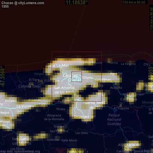
» NASA, Earths city lights 1995
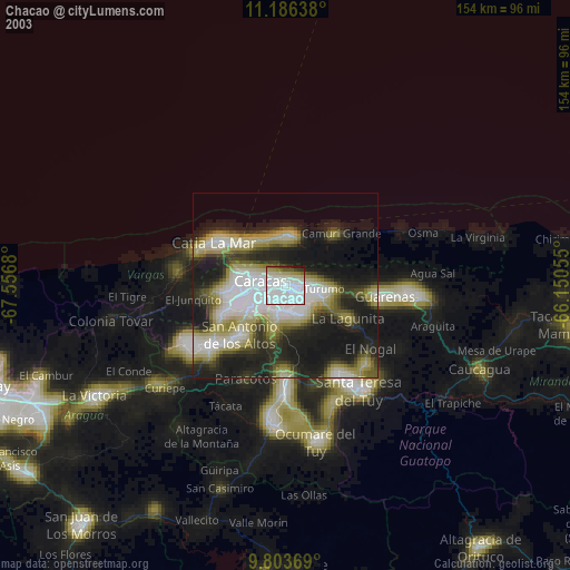
» NASA city lights 2003
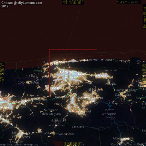
» Earth at Night: Flat Maps 2012, 2016