Los Dos Caminos night lights from space
Night Light of Los Dos Caminos (Miranda) from space (Venezuela) Src. Average luminocity for 10x10km area is 77.6488% and for 50x50km: 30.2828%.
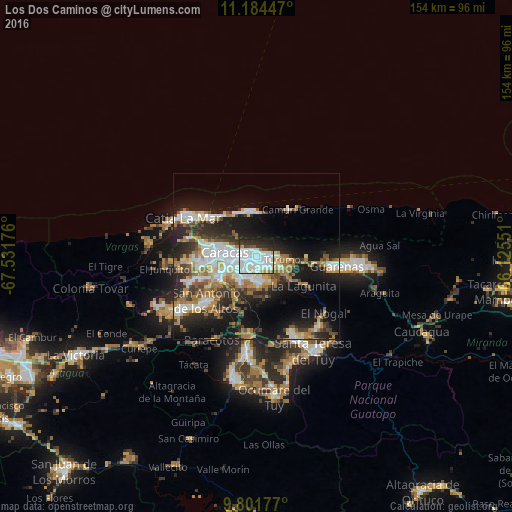
Analysis of Los Dos Caminos night lights 2016
Square area 10x10 km:
 44.42%
90-99
18.8%80-89
3.1%70-79
2.48%60-69
1.86%50-59
2.07%40-49
3.31%30-39
8.06%20-29
12.6%10-19
3.31%0-9
0%Square area 50x50 km:
6.68%90-99
5.21%80-89
2.59%70-79
3.82%60-69
5.82%50-59
2.5%40-49
3.15%30-39
4.91%20-29
8.78%10-19
16.16%0-9
40.39%Clear (daylight) street map image can be seen on geolist.org.
Map coordinates:
11° 11' 4.1" North, 67° 31' 54.3" West
10° 29' 38" North, 66° 49' 43.1" West
9° 48' 6.4" North, 66° 7' 31.8" West
Some cities around Los Dos Caminos sort by population:
• Caracas
5.6 km =3.5 mi,  263°
263°
• Petare
3 km =1.9 mi,  129°
129°
• Baruta
8.4 km =5.2 mi,  217°
217°
• El Cafetal
3.2 km =2 mi,  181°
181°
• Chacao
2.7 km =1.7 mi,  274°
274°
• El Hatillo
7.8 km =4.8 mi, 177°
• La Dolorita
4.7 km =2.9 mi,  97°
97°
• Caucagüito
9.9 km =6.2 mi,  94°
94°
3634184 (p: 58,168)
Sources (retrieved 2019-11-25):
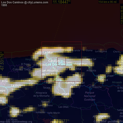
» NASA, Earths city lights 1995
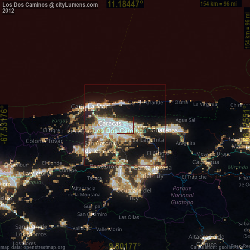
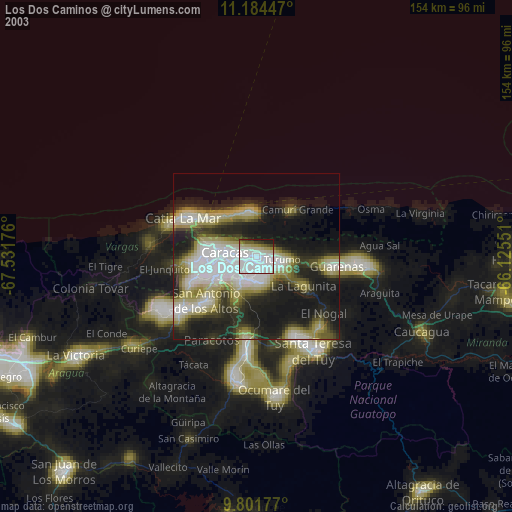
» NASA city lights 2003
» Earth at Night: Flat Maps 2012, 2016