Yangiyŭl night lights from space
Night Light of Yangiyŭl (Toshkent) from space (Uzbekistan) Src. Average luminocity for 10x10km area is 46.1071% and for 50x50km: 19.7528%.
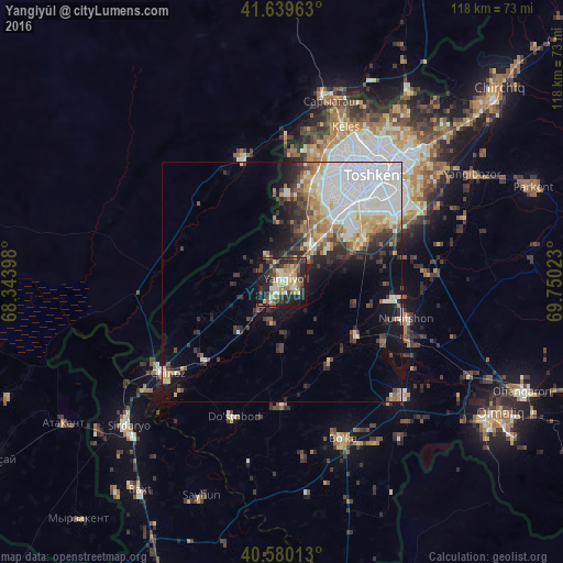
Analysis of Yangiyŭl night lights 2016
Square area 10x10 km:
 1.46%
1.46%90-99
8.12%80-89
11.2%70-79
5.52%60-69
6.66%50-59
8.6%40-49
6.49%30-39
12.82%20-29
16.4%10-19
20.94%0-9
1.79%Square area 50x50 km:
6.36%90-99
3.58%80-89
2%70-79
1.67%60-69
2.22%50-59
1.71%40-49
1.86%30-39
3.22%20-29
3.88%10-19
6.38%0-9
67.12%Clear (daylight) street map image can be seen on geolist.org.
Map coordinates:
41° 38' 22.7" North, 68° 20' 38.3" East
41° 6' 43.3" North, 69° 2' 49.6" East
40° 34' 48.5" North, 69° 45' 0.8" East
Some cities around Yangiyŭl sort by population:
• Tashkent
22.1 km =13.7 mi,  39°
39°
• Piskent
34.9 km =21.7 mi,  133°
133°
• Bektemir
26.4 km =16.4 mi,  65°
65°
• Zafar
18.9 km =11.7 mi,  220°
220°
• Chinoz
30.9 km =19.2 mi,  230°
230°
• Tŭytepa
27.9 km =17.3 mi,  108°
108°
• Ŭrtaowul
11.7 km =7.3 mi, 44°
• Amir Timur
13.6 km =8.5 mi, 220°
1512339 (p: 60,000)
Sources (retrieved 2019-11-25):
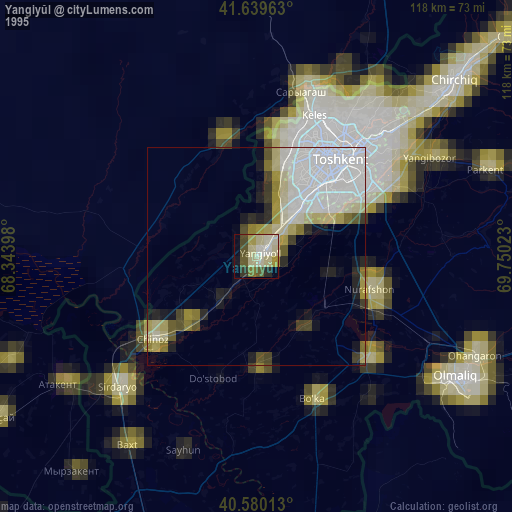
» NASA, Earths city lights 1995
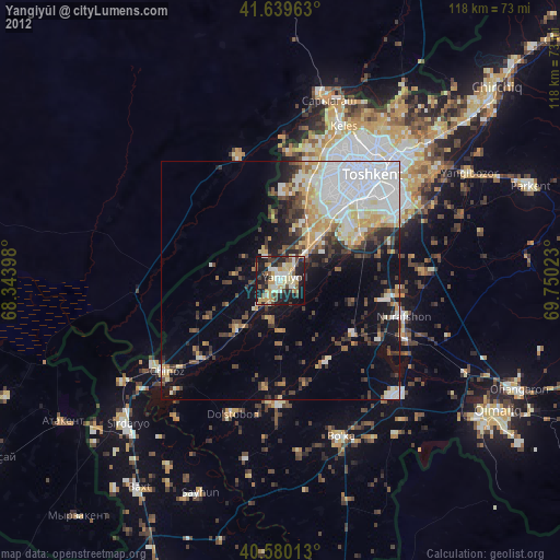
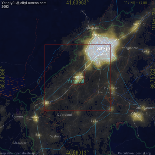
» NASA city lights 2003
» Earth at Night: Flat Maps 2012, 2016