Bektemir night lights from space
Night Light of Bektemir (Toshkent Shahri) from space (Uzbekistan) Src. Average luminocity for 10x10km area is 51.6737% and for 50x50km: 32.7551%.
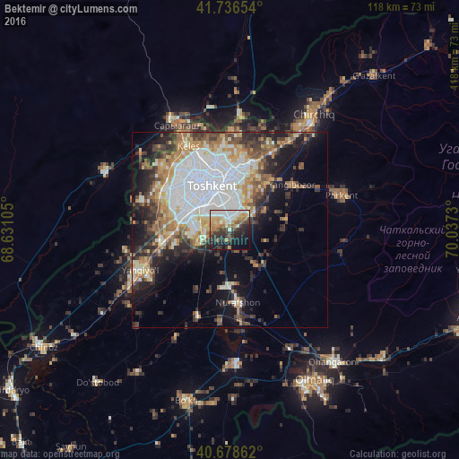
Analysis of Bektemir night lights 2016
Square area 10x10 km:
 10.39%
90-99
11.53%80-89
3.57%70-79
7.63%60-69
9.58%50-59
3.9%40-49
7.47%30-39
11.2%20-29
13.15%10-19
16.88%0-9
4.71%Square area 50x50 km:
9.47%90-99
5.83%80-89
3.2%70-79
3.61%60-69
4.54%50-59
3.59%40-49
3.91%30-39
5.36%20-29
6.05%10-19
9.88%0-9
44.57%Clear (daylight) street map image can be seen on geolist.org.
Map coordinates:
41° 44' 11.5" North, 68° 37' 51.8" East
41° 12' 35" North, 69° 20' 3" East
40° 40' 43" North, 70° 2' 14.3" East
Some cities around Bektemir sort by population:
• Tashkent
11.6 km =7.2 mi,  301°
301°
• Yangiyŭl
26.4 km =16.4 mi,  245°
245°
• Parkent
30.1 km =18.7 mi,  71°
71°
• Qibray
22.8 km =14.2 mi,  28°
28°
• Salor
18.5 km =11.5 mi,  12°
12°
• Saryaghash, KZ
31.1 km =19.3 mi,  333°
333°
• Tŭytepa
19.9 km =12.4 mi,  173°
173°
• Ŭrtaowul
16 km =9.9 mi,  260°
260°
1514396 (p: 26,380)
Sources (retrieved 2019-11-25):
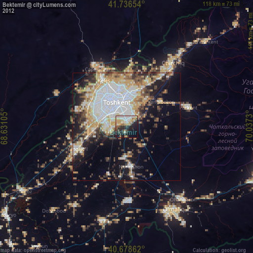
» Earth at Night: Flat Maps 2012, 2016