Yangiobod night lights from space
Night Light of Yangiobod (Toshkent) from space (Uzbekistan) Src. Average luminocity for 10x10km area is 0.8977% and for 50x50km: 2.5942%.
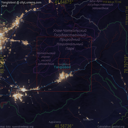
Analysis of Yangiobod night lights 2016
Square area 10x10 km:
 0%
0%90-99
0%80-89
0%70-79
0%60-69
0%50-59
0%40-49
0%30-39
0%20-29
0%10-19
0%0-9
100%Square area 50x50 km:
0.01%90-99
0.29%80-89
0.32%70-79
0.41%60-69
0.44%50-59
0.59%40-49
0.33%30-39
0.64%20-29
0.6%10-19
2.36%0-9
94.03%Clear (daylight) street map image can be seen on geolist.org.
Map coordinates:
41° 38' 48.3" North, 69° 23' 27.4" East
41° 7' 9.1" North, 70° 5' 38.6" East
40° 35' 14.5" North, 70° 47' 49.9" East
Some cities around Yangiobod sort by population:
• Chirchiq
57.8 km =35.9 mi,  312°
312°
• Angren
12.1 km =7.5 mi,  159°
159°
• Olmaliq
51.6 km =32.1 mi,  233°
233°
• Parkent
40 km =24.9 mi,  299°
299°
• Ohangaron
45 km =28 mi,  238°
238°
• G‘azalkent
55.8 km =34.7 mi,  331°
331°
• Adrasmon, TJ
53.1 km =33 mi,  189°
189°
• Shaydon, TJ
54.4 km =33.8 mi, 156°
1512372 (p: 24,900)
Sources (retrieved 2019-11-25):
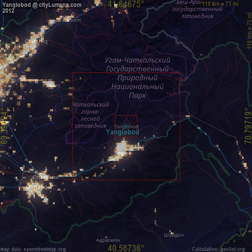
» Earth at Night: Flat Maps 2012, 2016