Denov night lights from space
Night Light of Denov (Surxondaryo) from space (Uzbekistan) Src. Average luminocity for 10x10km area is 25.4847% and for 50x50km: 3.1816%.
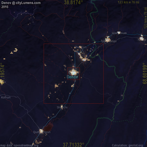
Analysis of Denov night lights 2016
Square area 10x10 km:
 3.57%
3.57%90-99
3.91%80-89
4.76%70-79
2.04%60-69
3.06%50-59
2.21%40-49
3.06%30-39
2.72%20-29
4.59%10-19
28.57%0-9
41.5%Square area 50x50 km:
0.15%90-99
0.28%80-89
0.31%70-79
0.33%60-69
0.37%50-59
0.43%40-49
0.68%30-39
0.87%20-29
1.09%10-19
2.44%0-9
93.06%Clear (daylight) street map image can be seen on geolist.org.
Map coordinates:
38° 49' 2.6" North, 67° 11' 44.7" East
38° 16' 2.9" North, 67° 53' 55.9" East
37° 42' 48" North, 68° 36' 7.2" East
Some cities around Denov sort by population:
• Dushanbe, TJ
82.3 km =51.1 mi,  68°
68°
• Tursunzoda, TJ
39.8 km =24.7 mi,  46°
46°
• Boysun
60.8 km =37.8 mi,  263°
263°
• Sho‘rchi
31.4 km =19.5 mi,  198°
198°
• Hisor, TJ
63.7 km =39.6 mi,  63°
63°
• Boshkengash, TJ
82.1 km =51 mi, 74°
• Khodzha-Maston, TJ
82.6 km =51.3 mi, 50°
• Shahrinav, TJ
50.8 km =31.6 mi, 48°
1217474 (p: 68,994)
Sources (retrieved 2019-11-25):
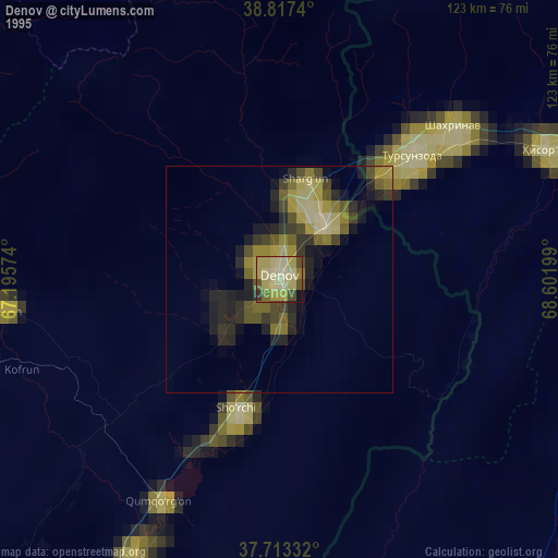
» NASA, Earths city lights 1995
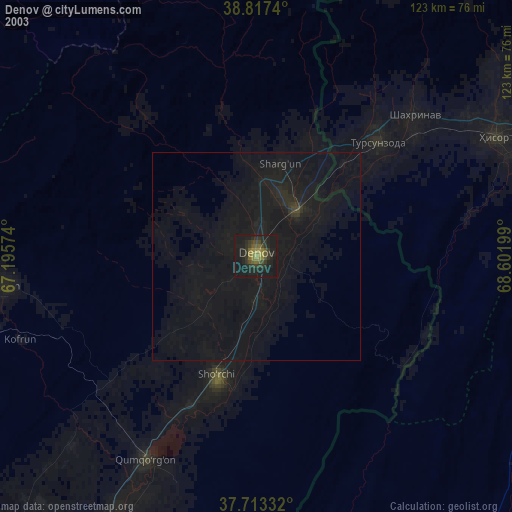
» NASA city lights 2003
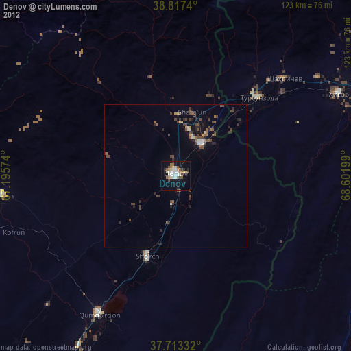
» Earth at Night: Flat Maps 2012, 2016