Shahrinav night lights from space
Night Light of Shahrinav (Republican Subordination) from space (Tajikistan) Src. Average luminocity for 10x10km area is 4.0455% and for 50x50km: 1.4199%.
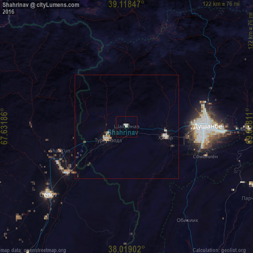
Analysis of Shahrinav night lights 2016
Square area 10x10 km:
 0.65%
0.65%90-99
1.95%80-89
0%70-79
0%60-69
0.65%50-59
0%40-49
0%30-39
0.65%20-29
0%10-19
0.65%0-9
95.45%Square area 50x50 km:
0.15%90-99
0.3%80-89
0.15%70-79
0.17%60-69
0.07%50-59
0.07%40-49
0.19%30-39
0.29%20-29
0.31%10-19
0.28%0-9
98.03%Clear (daylight) street map image can be seen on geolist.org.
Map coordinates:
39° 7' 6.5" North, 67° 37' 54.7" East
38° 34' 15.1" North, 68° 20' 5.9" East
38° 1' 8.5" North, 69° 2' 17.2" East
Some cities around Shahrinav sort by population:
• Dushanbe
38.8 km =24.1 mi,  95°
95°
• Denov, UZ
50.8 km =31.6 mi,  228°
228°
• Vahdat
59 km =36.7 mi,  91°
91°
• Tursunzoda
11.1 km =6.9 mi, 234°
• Hisor
19.5 km =12.1 mi,  105°
105°
• Boshkengash
42.5 km =26.4 mi, 105°
• Yovon
67.5 km =41.9 mi,  115°
115°
• Khodzha-Maston
31.9 km =19.8 mi,  52°
52°
1220566 (p: 5,385)
Sources (retrieved 2019-11-25):
» Earth at Night: Flat Maps 2012, 2016