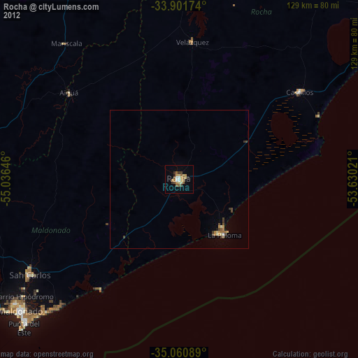
Rocha night lights from space
Night Light of Rocha from space (Uruguay) Src. Average luminocity for 10x10km area is 20.993% and for 50x50km: 1.7565%.
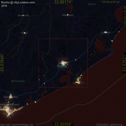
Analysis of Rocha night lights 2016
Square area 10x10 km:
 2.1%
2.1%90-99
2.1%80-89
2.97%70-79
2.8%60-69
3.85%50-59
3.5%40-49
5.42%30-39
2.45%20-29
0%10-19
12.24%0-9
62.59%Square area 50x50 km:
0.08%90-99
0.11%80-89
0.32%70-79
0.2%60-69
0.33%50-59
0.42%40-49
0.37%30-39
0.18%20-29
0.11%10-19
0.66%0-9
97.21%Clear (daylight) street map image can be seen on geolist.org.
Map coordinates:
33° 54' 6.3" South, 55° 2' 11.3" West
34° 28' 60" South, 54° 19' 60" West
35° 3' 39.2" South, 53° 37' 48.8" West
Some cities around Rocha sort by population:
• Maldonado
73 km =45.4 mi,  230°
230°
• Minas
83.8 km =52.1 mi,  278°
278°
• San Carlos
63.5 km =39.5 mi,  237°
237°
• Piriápolis
95.9 km =59.6 mi, 243°
• Castillos
53.8 km =33.4 mi,  53°
53°
• Punta del Este
75.3 km =46.8 mi, 226°
• Pan de Azúcar
88.9 km =55.2 mi,  248°
248°
• Lascano
90.9 km =56.5 mi,  7°
7°
3440777 (p: 25,515)
Sources (retrieved 2019-11-25):
» Earth at Night: Flat Maps 2012, 2016