Maldonado night lights from space
Night Light of Maldonado from space (Uruguay) Src. Average luminocity for 10x10km area is 43.9029% and for 50x50km: 4.0752%.
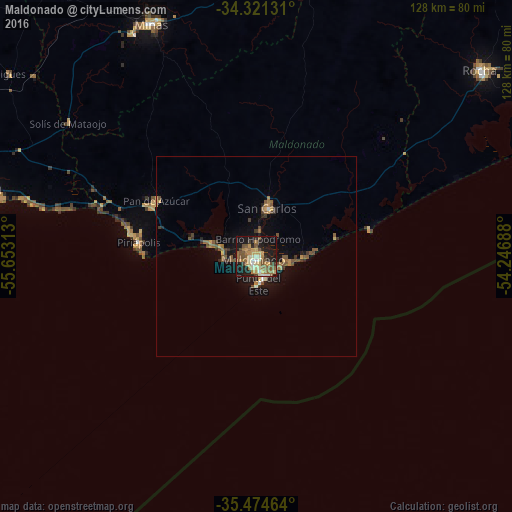
Analysis of Maldonado night lights 2016
Square area 10x10 km:
 1.83%
1.83%90-99
6.41%80-89
6.78%70-79
9.52%60-69
10.26%50-59
9.34%40-49
6.96%30-39
3.11%20-29
11.36%10-19
31.32%0-9
3.11%Square area 50x50 km:
0.14%90-99
0.34%80-89
0.45%70-79
0.58%60-69
0.8%50-59
0.96%40-49
0.81%30-39
0.63%20-29
0.83%10-19
3.2%0-9
91.26%Clear (daylight) street map image can be seen on geolist.org.
Map coordinates:
34° 19' 16.7" South, 55° 39' 11.3" West
34° 54' 0" South, 54° 57' 0" West
35° 28' 28.7" South, 54° 14' 48.8" West
Some cities around Maldonado sort by population:
• Minas
63.9 km =39.7 mi,  335°
335°
• Barros Blancos
97.5 km =60.6 mi,  279°
279°
• Rocha
73 km =45.4 mi,  50°
50°
• San Carlos
12.4 km =7.7 mi,  13°
13°
• Pando
94.3 km =58.6 mi, 282°
• Piriápolis
29.9 km =18.6 mi, 277°
• Punta del Este
5.5 km =3.4 mi,  164°
164°
• Pan de Azúcar
29.4 km =18.3 mi,  297°
297°
3441894 (p: 55,478)
Sources (retrieved 2019-11-25):
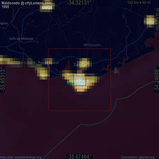
» NASA, Earths city lights 1995
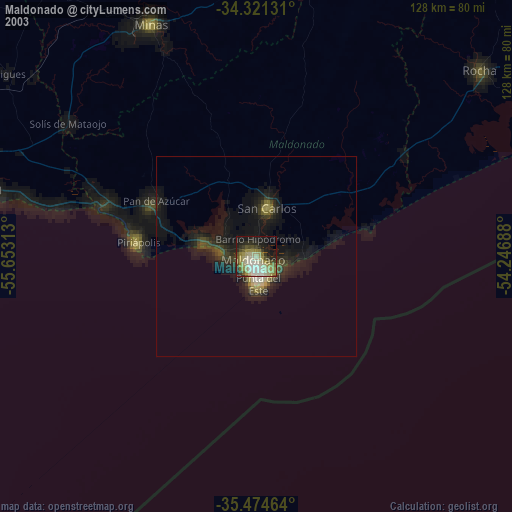
» NASA city lights 2003
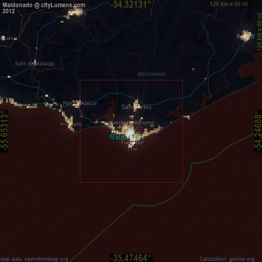
» Earth at Night: Flat Maps 2012, 2016