Pando night lights from space
Night Light of Pando (Canelones) from space (Uruguay) Src. Average luminocity for 10x10km area is 41.5403% and for 50x50km: 23.8537%.
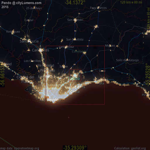
Analysis of Pando night lights 2016
Square area 10x10 km:
 3.66%
3.66%90-99
5.86%80-89
5.86%70-79
8.06%60-69
3.66%50-59
8.06%40-49
5.31%30-39
9.52%20-29
20.33%10-19
27.66%0-9
2.01%Square area 50x50 km:
5.03%90-99
4.38%80-89
2.53%70-79
3.26%60-69
3.7%50-59
4.68%40-49
2.7%30-39
2.39%20-29
4.34%10-19
9.44%0-9
57.55%Clear (daylight) street map image can be seen on geolist.org.
Map coordinates:
34° 8' 13.9" South, 56° 39' 41.5" West
34° 43' 1.8" South, 55° 57' 30.2" West
35° 17' 35.1" South, 55° 15' 19" West
Some cities around Pando sort by population:
• Las Piedras
23.9 km =14.9 mi,  266°
266°
• Barros Blancos
5.6 km =3.5 mi,  225°
225°
• La Paz
24.9 km =15.5 mi,  258°
258°
• Progreso
24.3 km =15.1 mi,  283°
283°
• Paso de Carrasco
18.1 km =11.2 mi,  208°
208°
• Colonia Nicolich
12.5 km =7.8 mi, 208°
• Joaquín Suárez
7.2 km =4.5 mi,  254°
254°
• Sauce
12.1 km =7.5 mi,  306°
306°
3441354 (p: 24,047)
Sources (retrieved 2019-11-25):
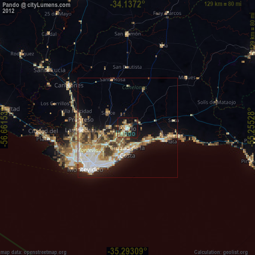
» Earth at Night: Flat Maps 2012, 2016