La Paz night lights from space
Night Light of La Paz (Canelones) from space (Uruguay) Src. Average luminocity for 10x10km area is 63.9414% and for 50x50km: 26.941%.
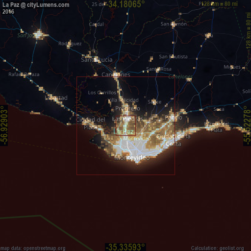
Analysis of La Paz night lights 2016
Square area 10x10 km:
 7.14%
7.14%90-99
8.61%80-89
8.79%70-79
11.17%60-69
15.02%50-59
27.11%40-49
13.92%30-39
2.75%20-29
4.58%10-19
0.92%0-9
0%Square area 50x50 km:
5.42%90-99
4.56%80-89
2.93%70-79
3.5%60-69
4.57%50-59
5.54%40-49
3.78%30-39
2.73%20-29
4.62%10-19
10.29%0-9
52.07%Clear (daylight) street map image can be seen on geolist.org.
Map coordinates:
34° 10' 50.3" South, 56° 55' 44.5" West
34° 45' 37.1" South, 56° 13' 33.2" West
35° 20' 9.3" South, 55° 31' 22" West
Some cities around La Paz sort by population:
• Montevideo
16.3 km =10.1 mi,  167°
167°
• Las Piedras
3.4 km =2.1 mi,  10°
10°
• Delta del Tigre
12.7 km =7.9 mi,  267°
267°
• Progreso
10.4 km =6.5 mi,  4°
4°
• Paso de Carrasco
19.4 km =12.1 mi,  125°
125°
• Colonia Nicolich
19.4 km =12.1 mi,  108°
108°
• Joaquín Suárez
17.7 km =11 mi,  80°
80°
• Sauce
19.1 km =11.9 mi,  50°
50°
3442098 (p: 19,913)
Sources (retrieved 2019-11-25):
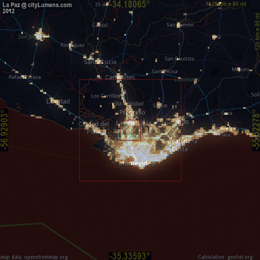
» Earth at Night: Flat Maps 2012, 2016